Approximate Location Map
Large Map »
Latitude: 51.4321 / 51°25'55"N
Longitude: -1.5396 / 1°32'22"W
OS Eastings: 432105
OS Northings: 170447
OS Grid: SU321704
Mapcode National: GBR 6ZZ.1LF
Mapcode Global: VHC1S.88GG
Plus Code: 9C3WCFJ6+R5
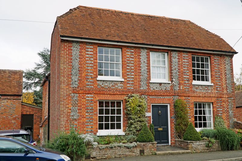
Entry Name: Stag House
Listing Date: 6 March 1985
Grade: II
Source: Historic England
Source ID: 1034143
English Heritage Legacy ID: 310579
ID on this website: 101034143
Location: Chilton Foliat, Wiltshire, RG17
County: Wiltshire
Civil Parish: Chilton Foliat
Built-Up Area: Chilton Foliat
Traditional County: Wiltshire
Lieutenancy Area (Ceremonial County): Wiltshire
Tagged with: House
SU 37 SW CHILTON FOLIAT A.419
(north side)
5/119 No 59 (Stag House)
II
House. C18-C19. Red and blue patterned brick. Tiled roof. 2-
storey, 3 bays. Central 4-panelled door and early C19 sashes with
gauged brick heads. Plat band. Right rear wing of 1 bay with
stack. Sun Insurance sign over door.
Listing NGR: SU3205570515
External links are from the relevant listing authority and, where applicable, Wikidata. Wikidata IDs may be related buildings as well as this specific building. If you want to add or update a link, you will need to do so by editing the Wikidata entry.


Other nearby listed buildings
