Approximate Location Map
Large Map »
Latitude: 51.4424 / 51°26'32"N
Longitude: -1.6052 / 1°36'18"W
OS Eastings: 427533
OS Northings: 171559
OS Grid: SU275715
Mapcode National: GBR 5YC.GZB
Mapcode Global: VHC1R.407M
Plus Code: 9C3WC9RV+WW
Entry Name: 1, High Street
Listing Date: 22 August 1966
Grade: II
Source: Historic England
Source ID: 1034088
English Heritage Legacy ID: 310651
ID on this website: 101034088
Location: Ramsbury, Wiltshire, SN8
County: Wiltshire
Civil Parish: Ramsbury
Built-Up Area: Ramsey
Traditional County: Wiltshire
Lieutenancy Area (Ceremonial County): Wiltshire
Tagged with: Building
SU 27 SE RAMSBURY HIGH STREET
(south side)
10/193 No 1
22.8.66
GV II
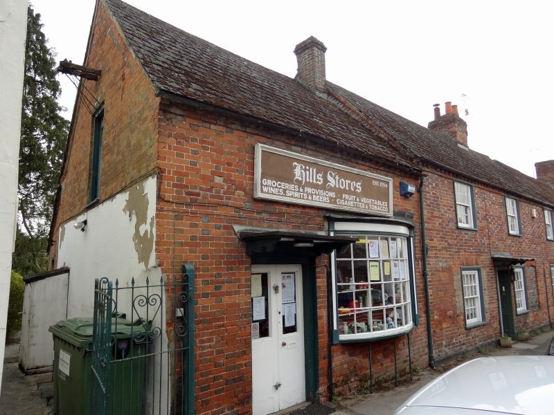
House. c1820-40. Diaper brickwork with slate roof. 2-storey, 3
bays with later addition left containing shop. 4-panelled door in
centre bay with reeded doorcase and simple bracketed canopy. 16-
pane sashes with wide moulded boxes. Brick dentilled eaves. 4-flue
stack between bays 2 and 3 where blocked window on elevation.
Listing NGR: SU2754071555
External links are from the relevant listing authority and, where applicable, Wikidata. Wikidata IDs may be related buildings as well as this specific building. If you want to add or update a link, you will need to do so by editing the Wikidata entry.


Other nearby listed buildings
