Approximate Location Map
Large Map »
Latitude: 51.4421 / 51°26'31"N
Longitude: -1.6057 / 1°36'20"W
OS Eastings: 427498
OS Northings: 171533
OS Grid: SU274715
Mapcode National: GBR 5YC.GW3
Mapcode Global: VHC1R.30ZS
Plus Code: 9C3WC9RV+VP
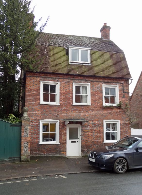
Entry Name: Evelyn House
Listing Date: 22 August 1966
Grade: II
Source: Historic England
Source ID: 1365473
English Heritage Legacy ID: 310654
ID on this website: 101365473
Location: Ramsbury, Wiltshire, SN8
County: Wiltshire
Civil Parish: Ramsbury
Built-Up Area: Ramsey
Traditional County: Wiltshire
Lieutenancy Area (Ceremonial County): Wiltshire
Tagged with: House
SU 27 SE RAMSBURY HIGH STREET
(south side)
10/196 No 7 (Evelyn House)
22.8.66
GV II
House. Early C19. Diaper brickwork with tiled roof. 2-storey and
attic. 3 narrow window bays. Off-centre door with glazed panel and
simple bracketed canopy. 4-pane sashes with wide moulded boxes and
segmental brick heads with blue strings. Cogged eaves. Tall
mansard roof with flat dormer. Gable stacks.
Listing NGR: SU2750171525
External links are from the relevant listing authority and, where applicable, Wikidata. Wikidata IDs may be related buildings as well as this specific building. If you want to add or update a link, you will need to do so by editing the Wikidata entry.


Other nearby listed buildings
