Approximate Location Map
Large Map »
Latitude: 51.4419 / 51°26'30"N
Longitude: -1.6111 / 1°36'39"W
OS Eastings: 427126
OS Northings: 171507
OS Grid: SU271715
Mapcode National: GBR 5YC.FJ7
Mapcode Global: VHC1R.104Y
Plus Code: 9C3WC9RQ+QH
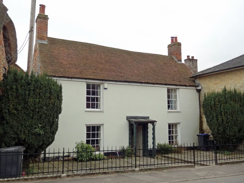
Entry Name: 79, High Street
Listing Date: 6 March 1985
Grade: II
Source: Historic England
Source ID: 1183770
English Heritage Legacy ID: 310659
ID on this website: 101183770
Location: Ramsbury, Wiltshire, SN8
County: Wiltshire
Civil Parish: Ramsbury
Built-Up Area: Ramsey
Traditional County: Wiltshire
Lieutenancy Area (Ceremonial County): Wiltshire
Tagged with: Building
SU 27 SE RAMSBURY HIGH STREET
(south side)
10/201 No 79
II
Detached house. C18. Stucco on brickwork. Tiled roof. 2-storey,
3 bays, with central stair hall, 1 room deep. 6-panelled door with
C20 open timber porch. 12-pane sashes. Gable stacks.
Listing NGR: SU2713071501
External links are from the relevant listing authority and, where applicable, Wikidata. Wikidata IDs may be related buildings as well as this specific building. If you want to add or update a link, you will need to do so by editing the Wikidata entry.


Other nearby listed buildings
