Approximate Location Map
Large Map »
Latitude: 51.4427 / 51°26'33"N
Longitude: -1.6016 / 1°36'5"W
OS Eastings: 427782
OS Northings: 171601
OS Grid: SU277716
Mapcode National: GBR 5YC.HVX
Mapcode Global: VHC1K.6Z4W
Plus Code: 9C3WC9VX+38
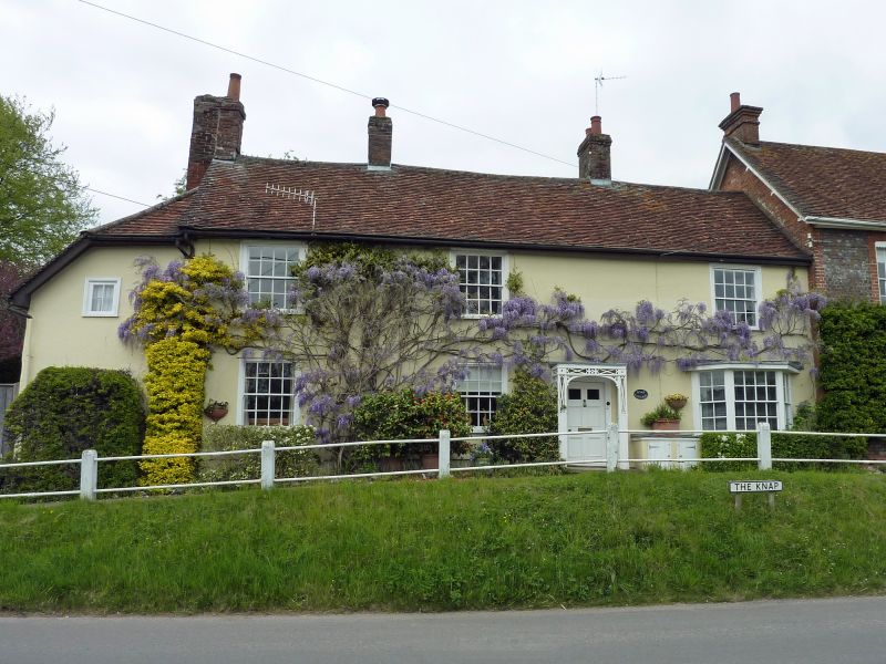
Entry Name: Knap Cottage
Listing Date: 22 August 1966
Grade: II
Source: Historic England
Source ID: 1034096
English Heritage Legacy ID: 310671
ID on this website: 101034096
Location: Ramsbury, Wiltshire, SN8
County: Wiltshire
Civil Parish: Ramsbury
Built-Up Area: Ramsey
Traditional County: Wiltshire
Lieutenancy Area (Ceremonial County): Wiltshire
Tagged with: Cottage
SU 27 SE RAMSBURY THE KNAP
10/213 Knap Cottage
22.8.66
GV II
House. Mid C18. Stucco with tiled roof. 2-storey, 3 bays with left
lean-to. 6-panel door with raised mouldings in centre bay, the
upper panels glazed, within C19 wood open trellis porch. Moulded
timber architraves to C19 4- and 16-pane sashes, many with crown
glass. Canted flat roofed bay window to right bay. Stacks between
each bay, and to left gable before extension.
Interior has cross passage behind main stack.
Listing NGR: SU2778271601
External links are from the relevant listing authority and, where applicable, Wikidata. Wikidata IDs may be related buildings as well as this specific building. If you want to add or update a link, you will need to do so by editing the Wikidata entry.


Other nearby listed buildings
