Approximate Location Map
Large Map »
Latitude: 51.4602 / 51°27'36"N
Longitude: -1.5714 / 1°34'17"W
OS Eastings: 429872
OS Northings: 173552
OS Grid: SU298735
Mapcode National: GBR 5Y6.KHF
Mapcode Global: VHC1K.QK3H
Plus Code: 9C3WFC6H+3C
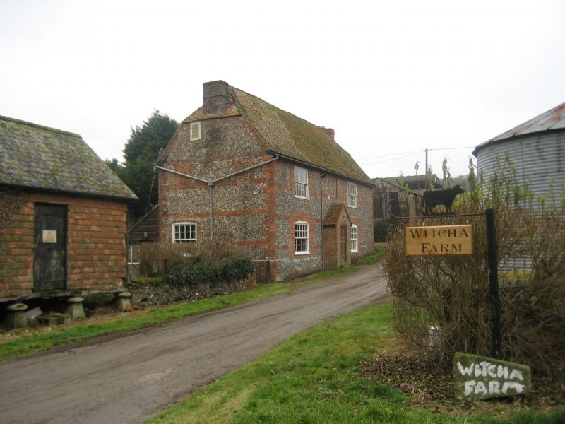
Entry Name: Witcha Farmhouse
Listing Date: 6 March 1985
Grade: II
Source: Historic England
Source ID: 1034098
English Heritage Legacy ID: 310675
ID on this website: 101034098
Location: Wiltshire, SN8
County: Wiltshire
Civil Parish: Ramsbury
Traditional County: Wiltshire
Lieutenancy Area (Ceremonial County): Wiltshire
Tagged with: Farmhouse
SU 27 SE RAMSBURY MEMBURY LANE
4/217 Witcha Farmhouse
II
Farmhouse, early C19. Brick laced and panelled flintwork with
brick quoins. Tiled roof. 2-storey 3 bays, symmetrical with central
entrance under later C19 gabled porch. 5-panelled door. 20-pane
sashes with segmental brick heads. Half-hipped roof with gable
stacks. Sun insurance sign over door.
Listing NGR: SU2987273552
External links are from the relevant listing authority and, where applicable, Wikidata. Wikidata IDs may be related buildings as well as this specific building. If you want to add or update a link, you will need to do so by editing the Wikidata entry.


Other nearby listed buildings
