Approximate Location Map
Large Map »
Latitude: 51.4096 / 51°24'34"N
Longitude: -1.5737 / 1°34'25"W
OS Eastings: 429745
OS Northings: 167928
OS Grid: SU297679
Mapcode National: GBR 5YS.JYJ
Mapcode Global: VHC1R.NTXS
Plus Code: 9C3WCC5G+RG
Entry Name: 44, Brewhouse Hill
Listing Date: 30 July 1986
Grade: II
Source: Historic England
Source ID: 1183507
English Heritage Legacy ID: 310732
ID on this website: 101183507
Location: Froxfield, Wiltshire, SN8
County: Wiltshire
Civil Parish: Froxfield
Traditional County: Wiltshire
Lieutenancy Area (Ceremonial County): Wiltshire
Tagged with: Building
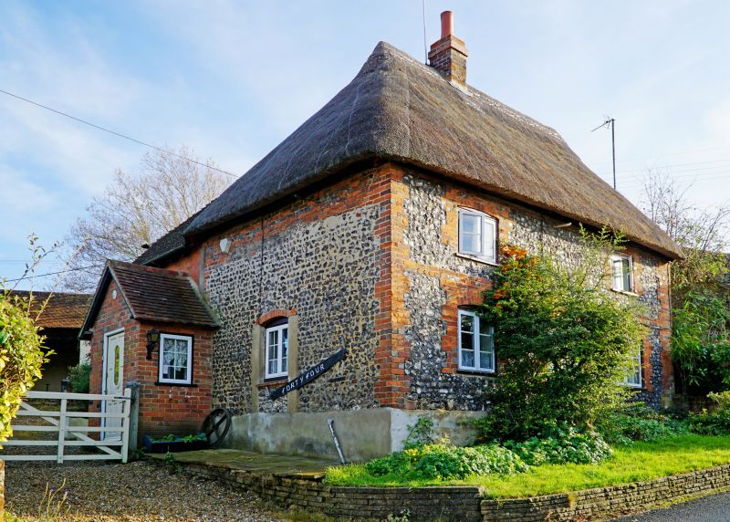
FROXFIELD
SU 26 NE
2/12
BREWHOUSE HILL
No 44
GV
II
Cottage. C18. Flint with brick dressings and thatched roof. Two-
storey,2 bays, lobby entry plan, the central entrance now blocked
and replaced by gabled porch entrance to rear lean-to. C19 timber
casement windows. Roof hipped and small stack.
Listing NGR: SU2974567928
External links are from the relevant listing authority and, where applicable, Wikidata. Wikidata IDs may be related buildings as well as this specific building. If you want to add or update a link, you will need to do so by editing the Wikidata entry.


Other nearby listed buildings
