Approximate Location Map
Large Map »
Latitude: 51.4256 / 51°25'32"N
Longitude: -1.6039 / 1°36'13"W
OS Eastings: 427639
OS Northings: 169697
OS Grid: SU276696
Mapcode National: GBR 5YK.HBV
Mapcode Global: VHC1R.4FZG
Plus Code: 9C3WC9GW+6F
Entry Name: Hugditch
Listing Date: 30 July 1986
Grade: II
Source: Historic England
Source ID: 1034083
English Heritage Legacy ID: 310744
ID on this website: 101034083
Location: Rudge, Wiltshire, SN8
County: Wiltshire
Civil Parish: Froxfield
Traditional County: Wiltshire
Lieutenancy Area (Ceremonial County): Wiltshire
Tagged with: Building Thatched cottage
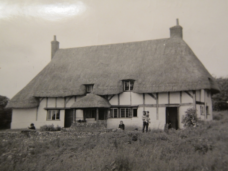
FROXFIELD
SU 26 NE
2/24
RAMSBURY ROAD
(east side)
Hugditch
II
House. C16 - C17. Timber framed with colourwashed brick noggings
and thatched roof. Single-storey and attic, 3 bays and end lean-
tos, that to right framed. Two bay 2-storey rear wing. Boarded
door in right lean-to under thatched canopy. Leaded windows and
C20 patio doors crossing centre 2 bays. Three dormers. Gable
stacks and thatch carried down over ends. Interior not seen.
Listing NGR: SU2763969697
External links are from the relevant listing authority and, where applicable, Wikidata. Wikidata IDs may be related buildings as well as this specific building. If you want to add or update a link, you will need to do so by editing the Wikidata entry.


Other nearby listed buildings
