Approximate Location Map
Large Map »
Latitude: 51.3424 / 51°20'32"N
Longitude: -1.6316 / 1°37'53"W
OS Eastings: 425757
OS Northings: 160433
OS Grid: SU257604
Mapcode National: GBR 5ZH.VPY
Mapcode Global: VHC23.NJT8
Plus Code: 9C3W89R9+X9
Entry Name: Kirkholm
Listing Date: 30 July 1986
Grade: II
Source: Historic England
Source ID: 1034024
English Heritage Legacy ID: 310752
ID on this website: 101034024
Location: East Grafton, Wiltshire, SN8
County: Wiltshire
Civil Parish: Grafton
Built-Up Area: East Grafton
Traditional County: Wiltshire
Lieutenancy Area (Ceremonial County): Wiltshire
Tagged with: Building
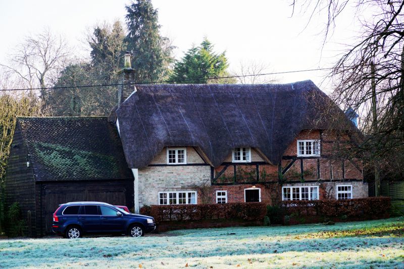
GRAFTON THE GREEN, East Grafton
SU 26 SE
(east side)
5/32 Nos 253 and 255 (Kirkholm)
GV II
House, once 3 cottages. C17. Timber framed with brick noggings.
Pressed iron roof and weatherboarding to side. Two-storey, 2 bays
with gable stack and 2-bay cross wing on right. Entrance into 2nd
bay; C20 door and timber casement windows. Two flush dormers built
in when eaves line raised.
Interior: Stack between rooms of cross wing removed c1965.
Listing NGR: SU2575760433
External links are from the relevant listing authority and, where applicable, Wikidata. Wikidata IDs may be related buildings as well as this specific building. If you want to add or update a link, you will need to do so by editing the Wikidata entry.


Other nearby listed buildings
