Approximate Location Map
Large Map »
Latitude: 51.3525 / 51°21'9"N
Longitude: -1.6176 / 1°37'3"W
OS Eastings: 426725
OS Northings: 161564
OS Grid: SU267615
Mapcode National: GBR 5ZH.5V1
Mapcode Global: VHC23.X86H
Plus Code: 9C3W993J+2X
Entry Name: Barn West of the Croft
Listing Date: 30 July 1986
Grade: II
Source: Historic England
Source ID: 1183769
English Heritage Legacy ID: 310778
ID on this website: 101183769
Location: Wilton, Wiltshire, SN8
County: Wiltshire
Civil Parish: Grafton
Traditional County: Wiltshire
Lieutenancy Area (Ceremonial County): Wiltshire
Tagged with: Barn
GRAFTON WILTON (north side)
SU 26 SE 5/58
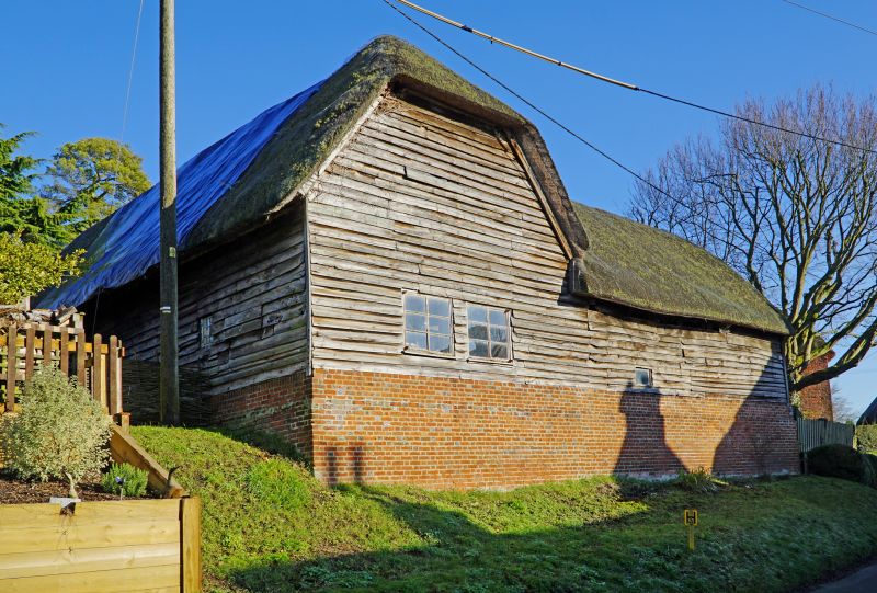
Barn west of The Croft
GV II
Barn and attached farm building, C18. Four-bay timber framed barn on high brick sills, weatherboarded with thatched roof. Cart doors facing house in 3rd bay, altered, and opposing doors removed and studded and boarded. Attached building at right angles of similar construction. An important element in the street.
Listing NGR: SU2672561564
External links are from the relevant listing authority and, where applicable, Wikidata. Wikidata IDs may be related buildings as well as this specific building. If you want to add or update a link, you will need to do so by editing the Wikidata entry.


Other nearby listed buildings
