Approximate Location Map
Large Map »
Latitude: 51.3593 / 51°21'33"N
Longitude: -1.6266 / 1°37'35"W
OS Eastings: 426095
OS Northings: 162309
OS Grid: SU260623
Mapcode National: GBR 5Z9.PLB
Mapcode Global: VHC23.R3FB
Plus Code: 9C3W995F+P9
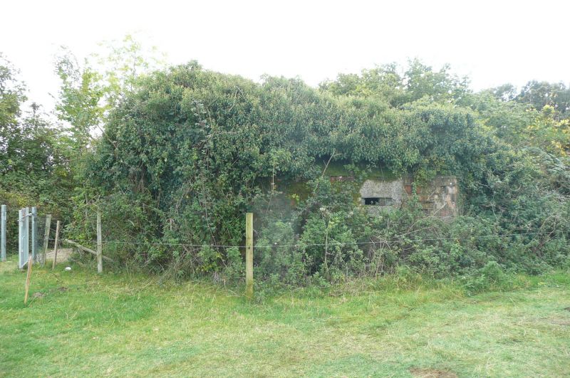
Entry Name: Pillbox Circa 50 Metres North West of Crofton Pumping Station at Su 261624
Listing Date: 15 November 1990
Grade: II
Source: Historic England
Source ID: 1249668
English Heritage Legacy ID: 310950
ID on this website: 101249668
Location: Crofton, Wiltshire, SN8
County: Wiltshire
Civil Parish: Great Bedwyn
Traditional County: Wiltshire
Lieutenancy Area (Ceremonial County): Wiltshire
Tagged with: Pillbox
GREAT BEDWYN KENNET & AVON CANAL
SU 26 SE
5/153 Pillbox c50M NW of
Crofton Pumping
Station
at SU 261624
- II
Anti-tank pillbox, Type FW3/28. 1940. War Office design. Rectangular. Concrete, with
permanent Phorpres hollow brick shuttering. Part of Southern Command's GHQ Line Blue for defence of UK.
Listing NGR: SU2609562309
External links are from the relevant listing authority and, where applicable, Wikidata. Wikidata IDs may be related buildings as well as this specific building. If you want to add or update a link, you will need to do so by editing the Wikidata entry.


Other nearby listed buildings
