Approximate Location Map
Large Map »
Latitude: 51.2634 / 51°15'48"N
Longitude: -1.7996 / 1°47'58"W
OS Eastings: 414081
OS Northings: 151605
OS Grid: SU140516
Mapcode National: GBR 4YX.MW4
Mapcode Global: VHB4Y.RHHT
Plus Code: 9C3W7672+95
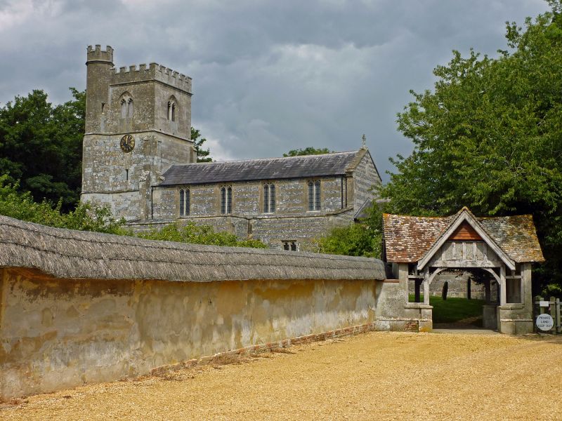
Entry Name: Lychgate and Wall Between Ofd Vicarage and the Churchyard
Listing Date: 3 June 1986
Grade: II
Source: Historic England
Source ID: 1300327
English Heritage Legacy ID: 310980
ID on this website: 101300327
Location: All Saints' Church, Enford, Wiltshire, SN9
County: Wiltshire
Civil Parish: Enford
Traditional County: Wiltshire
Lieutenancy Area (Ceremonial County): Wiltshire
Church of England Parish: Enford All Saints
Church of England Diocese: Salisbury
Tagged with: Lychgate
ENFORD ENFORD HILL
SU 15 SW (north side)
5/28 Lychgate and wall between Old
Vicarage and the Churchyard
GV II
Boundary wall between Old Vicarage garden and churchyard, C18/C19.
Rendered cob with thatched coping. Approximately 35 m run. Lych
gate of 1918, rendered brick and timber framing with tiled roof.
Included for group value.
Listing NGR: SU1408051602
External links are from the relevant listing authority and, where applicable, Wikidata. Wikidata IDs may be related buildings as well as this specific building. If you want to add or update a link, you will need to do so by editing the Wikidata entry.


Other nearby listed buildings
