Approximate Location Map
Large Map »
Latitude: 51.2603 / 51°15'37"N
Longitude: -1.7988 / 1°47'55"W
OS Eastings: 414134
OS Northings: 151256
OS Grid: SU141512
Mapcode National: GBR 4YX.VDF
Mapcode Global: VHB4Y.RLX6
Plus Code: 9C3W7662+4F
Entry Name: 7, Longstreet
Listing Date: 3 June 1986
Grade: II
Source: Historic England
Source ID: 1033976
English Heritage Legacy ID: 310992
ID on this website: 101033976
Location: Longstreet, Wiltshire, SN9
County: Wiltshire
Civil Parish: Enford
Traditional County: Wiltshire
Lieutenancy Area (Ceremonial County): Wiltshire
Church of England Parish: Enford All Saints
Church of England Diocese: Salisbury
Tagged with: Building Thatched cottage
SU 15 SW
5/40
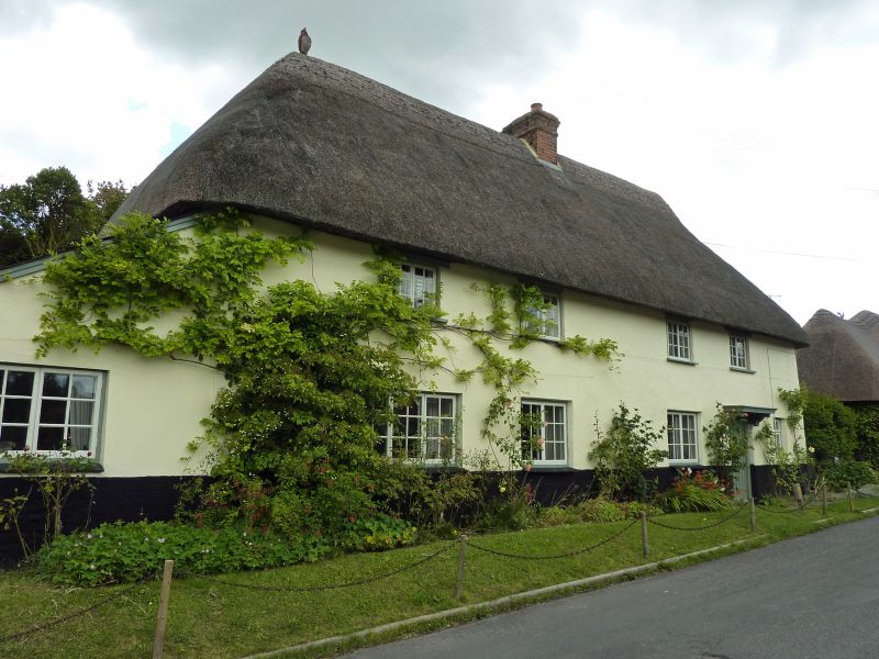
ENFORD
LONGSTREET (east side)
No 7
II
Pair cottages, now one house. Late C18-early C19. Rendered cob on flint footings. Thatched roof. Bilaterally symmetrical, each cottage of two bays. Boarded door and bracketed canopy to right bay. Casement windows. Roof hipped with central stack. Some timber framing internally.
Listing NGR: SU1413451256
External links are from the relevant listing authority and, where applicable, Wikidata. Wikidata IDs may be related buildings as well as this specific building. If you want to add or update a link, you will need to do so by editing the Wikidata entry.


Other nearby listed buildings
