Approximate Location Map
Large Map »
Latitude: 51.3775 / 51°22'39"N
Longitude: -2.0332 / 2°1'59"W
OS Eastings: 397782
OS Northings: 164273
OS Grid: ST977642
Mapcode National: GBR 2TL.GS3
Mapcode Global: VHB47.PMZV
Plus Code: 9C3V9XH8+2P
Entry Name: Milestone Ouside No 176
Listing Date: 3 April 1987
Grade: II
Source: Historic England
Source ID: 1365599
English Heritage Legacy ID: 311212
ID on this website: 101365599
Location: Wiltshire, SN15
County: Wiltshire
Civil Parish: Bromham
Traditional County: Wiltshire
Lieutenancy Area (Ceremonial County): Wiltshire
Church of England Parish: Bromham, Chittoe and Sandy Lane
Church of England Diocese: Salisbury
Tagged with: Milestone
ST 96 SE BROMHAM SAINT EDITH'S MARSH
(west side)
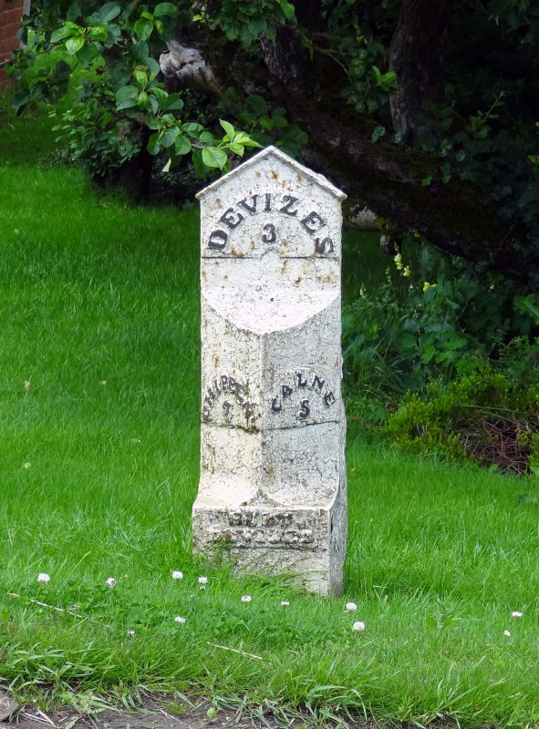
4/62 Milestone outside No 176
II
Milestone, early C19, stone wth triangular-plan cast-iron facing,
inscription on foot, Burt, Devizes, on South side, Chippenham 7, on
North side, Calne 5 and on flat gabled top, Devizes 3.
Listing NGR: ST9778264273
External links are from the relevant listing authority and, where applicable, Wikidata. Wikidata IDs may be related buildings as well as this specific building. If you want to add or update a link, you will need to do so by editing the Wikidata entry.


Other nearby listed buildings
