Approximate Location Map
Large Map »
Latitude: 51.4679 / 51°28'4"N
Longitude: -1.7135 / 1°42'48"W
OS Eastings: 419997
OS Northings: 174359
OS Grid: SU199743
Mapcode National: GBR 4WH.ZJ8
Mapcode Global: VHC1H.8C0L
Plus Code: 9C3WF79P+4J
Entry Name: Barn East of Rectory House
Listing Date: 2 September 1986
Grade: II
Source: Historic England
Source ID: 1033827
English Heritage Legacy ID: 311348
ID on this website: 101033827
Location: Ogbourne St George, Wiltshire, SN8
County: Wiltshire
Civil Parish: Ogbourne St. George
Built-Up Area: Ogbourne St George
Traditional County: Wiltshire
Lieutenancy Area (Ceremonial County): Wiltshire
Tagged with: Barn
SU 17 SE
7/96
OGBOURNE ST GEORGE
HIGH STREET
(south side)
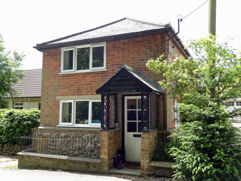
Barn east of Rectory House
GV
II
Small barn aligned along road. Late C18-early C19. Brick and
sarsen with flush brick piers. Tiled roof. Rear altered C20.
Roof quarter-hipped both ends and brick dentilled eaves and verges.
Pitching door in west gable with iron hoist arm. Listed for group
value with Rectory House.
Listing NGR: SU1999774359
External links are from the relevant listing authority and, where applicable, Wikidata. Wikidata IDs may be related buildings as well as this specific building. If you want to add or update a link, you will need to do so by editing the Wikidata entry.


Other nearby listed buildings
