Approximate Location Map
Large Map »
Latitude: 51.4108 / 51°24'38"N
Longitude: -1.8122 / 1°48'43"W
OS Eastings: 413160
OS Northings: 167993
OS Grid: SU131679
Mapcode National: GBR 4X4.JNB
Mapcode Global: VHB45.JSVV
Plus Code: 9C3WC56Q+84
Entry Name: 67 and 68 West Overton
Listing Date: 2 September 1986
Grade: II
Source: Historic England
Source ID: 1033809
English Heritage Legacy ID: 311405
ID on this website: 101033809
Location: West Overton, Wiltshire, SN8
County: Wiltshire
Civil Parish: West Overton
Traditional County: Wiltshire
Lieutenancy Area (Ceremonial County): Wiltshire
Tagged with: Building
SU 16 NW
9/153
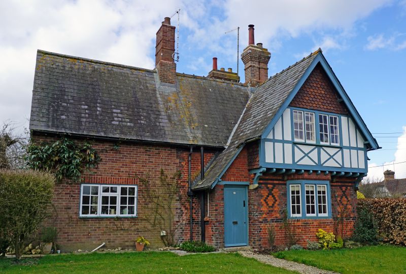
WEST OVERTON
VILLAGE CENTRE
(south side)
Nos 67 and 68
II
Pair of estate cottages. c1880. Patterned brickwork and timber
framing with patterned tile hanging to the upper floor, and slate
roof. Two storeys. Cruciform plan with entrances through framed
and boarded doors within lean-to's. Jettied timber framed gables
with painted noggings. Timber paned windows. Overhanging eaves
and barge boards, blue ridges and oversailing stacks.
Listing NGR: SU1316067993
External links are from the relevant listing authority and, where applicable, Wikidata. Wikidata IDs may be related buildings as well as this specific building. If you want to add or update a link, you will need to do so by editing the Wikidata entry.


Other nearby listed buildings
