Approximate Location Map
Large Map »
Latitude: 51.3566 / 51°21'23"N
Longitude: -1.8979 / 1°53'52"W
OS Eastings: 407208
OS Northings: 161948
OS Grid: SU072619
Mapcode National: GBR 3W9.T5T
Mapcode Global: VHB4J.251D
Plus Code: 9C3W9442+JV
Entry Name: Rustic Farmhouse
Listing Date: 29 April 1987
Grade: II
Source: Historic England
Source ID: 1033782
English Heritage Legacy ID: 311441
ID on this website: 101033782
Location: All Cannings, Wiltshire, SN10
County: Wiltshire
Civil Parish: All Cannings
Built-Up Area: All Cannings
Traditional County: Wiltshire
Lieutenancy Area (Ceremonial County): Wiltshire
Church of England Parish: All Cannings All Saints
Church of England Diocese: Salisbury
Tagged with: Farmhouse Thatched farmhouse
ALL CANNINGS THE STREET
SU 06 SE
(south west side)
7/21 Rustic Farmhouse
II
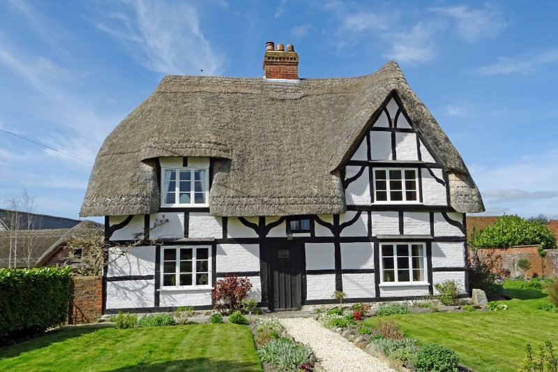
Farmhouse. Late C16. Timber framed with colourwashed brick
noggings mostly replacing original wattle and daub. Thatched roof.
'T' plan with narrow central bay containing lobby entry. To right,
a parlour, to left a kitchen, and in rear brewhouse or dairy.
Lean-tos in re-entrant angles, and outbuilding to rear. Framing 3
panels high with ogee corner braces. Right bay raised later to 2
storeys and gables. Tripartite timber casement windows. Raised
flush dormer to left bay. Rear wing has blocked original window
now covered by outshut under extension of roof, and another window
over boarded front door. Norwich Union firemark.
Interior: Stair in lobby with access from original kitchen.
Parlour has chamfered chalkstone fireplace with timber lintel, the
jamb bearing scratch date of 1593, and the lintel containing
cupboard. Kitchen has large square fireplace with curing cupboard,
a small ember hearth and access to former bread oven. Chamfered
spine beam with double bar stops. Rear bay has axial gable
fireplace with a second oven, which would have projected at rear,
now removed and blocked.
Listing NGR: SU0720861948
External links are from the relevant listing authority and, where applicable, Wikidata. Wikidata IDs may be related buildings as well as this specific building. If you want to add or update a link, you will need to do so by editing the Wikidata entry.


Other nearby listed buildings
