Approximate Location Map
Large Map »
Latitude: 51.4291 / 51°25'44"N
Longitude: -1.8569 / 1°51'24"W
OS Eastings: 410047
OS Northings: 170015
OS Grid: SU100700
Mapcode National: GBR 3VK.CCV
Mapcode Global: VHB44.RBQT
Plus Code: 9C3WC4HV+J7
Entry Name: Stones Restaurant
Listing Date: 29 April 1987
Grade: II
Source: Historic England
Source ID: 1033790
English Heritage Legacy ID: 311465
ID on this website: 101033790
Location: Avebury, Wiltshire, SN8
County: Wiltshire
Civil Parish: Avebury
Traditional County: Wiltshire
Lieutenancy Area (Ceremonial County): Wiltshire
Tagged with: Building
AVEBURY -
SU 17 SW
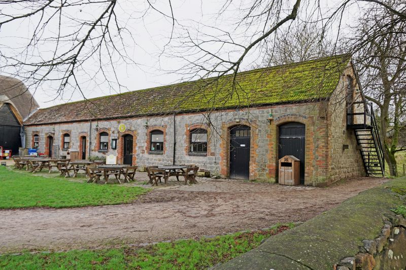
11/44 Stones Restaurant
GV II
Farm building, now restaurant and WCs, attached to south-east end
of Great Barn (q.v.) and enclosing former farmyard. Pre 1724, but
rebuilt mid C19. Sarsen with Bridgewater tiled roof. Ten bays,
with equally spaced doors and windows, all with brick dressings and
3 half-brick red and blue segmental arches. Listed for group value
with barn and with ditch of henge.
Listing NGR: SU1004770015
External links are from the relevant listing authority and, where applicable, Wikidata. Wikidata IDs may be related buildings as well as this specific building. If you want to add or update a link, you will need to do so by editing the Wikidata entry.


Other nearby listed buildings
