Approximate Location Map
Large Map »
Latitude: 51.4285 / 51°25'42"N
Longitude: -1.8581 / 1°51'29"W
OS Eastings: 409960
OS Northings: 169950
OS Grid: SU099699
Mapcode National: GBR 3VK.C25
Mapcode Global: VHB44.RC18
Plus Code: 9C3WC4HR+9Q
Entry Name: Unidentified Monument in Churchyard, 11 Metres South West of South Aisle, Church of St James
Listing Date: 29 April 1987
Grade: II
Source: Historic England
Source ID: 1033766
English Heritage Legacy ID: 311511
ID on this website: 101033766
Location: St James's Church, Avebury, Wiltshire, SN8
County: Wiltshire
Civil Parish: Avebury
Traditional County: Wiltshire
Lieutenancy Area (Ceremonial County): Wiltshire
Tagged with: Monument
AVEBURY HIGH STREET
SU 06 NE
(north side)
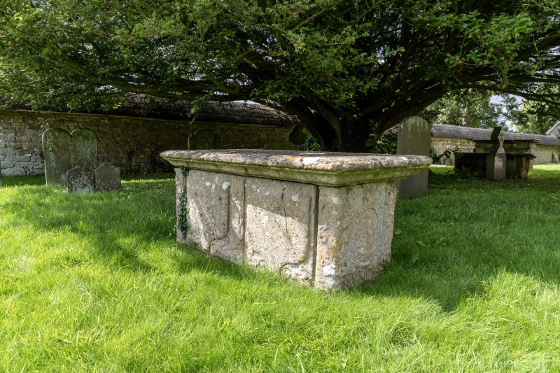
11/90 Unidentified monument in churchyard
llm south west of south aisle,
Church of St James
II
Chest tomb. C18. Limestone. Cyma table and moulded base. Raised
side shields between decorated pilasters. Inscriptions not
legible.
Listing NGR: SU0996069950
External links are from the relevant listing authority and, where applicable, Wikidata. Wikidata IDs may be related buildings as well as this specific building. If you want to add or update a link, you will need to do so by editing the Wikidata entry.


Other nearby listed buildings
