Approximate Location Map
Large Map »
Latitude: 51.3405 / 51°20'25"N
Longitude: -1.7615 / 1°45'41"W
OS Eastings: 416708
OS Northings: 160186
OS Grid: SU167601
Mapcode National: GBR 4XZ.ZD9
Mapcode Global: VHB4L.FK3Q
Plus Code: 9C3W86RQ+69
Entry Name: Norbury House
Listing Date: 30 October 1987
Grade: II
Source: Historic England
Source ID: 1192929
English Heritage Legacy ID: 311717
ID on this website: 101192929
Location: Pewsey, Wiltshire, SN9
County: Wiltshire
Civil Parish: Pewsey
Built-Up Area: Pewsey
Traditional County: Wiltshire
Lieutenancy Area (Ceremonial County): Wiltshire
Tagged with: House
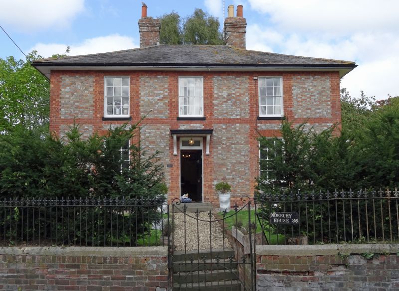
PEWSEY HIGH STREET
SU 16 SE (north side)
12/85 No 85 (Norbury House)
II
Detached house. Early C19. Vitrified brick with red brick
dressings, quoining and band. Slate roof. Two storeys and cellar.
Three x 2 bays. Central half-glazed door with bracketed canopy.
Twelve-paned sashes with finely gauged brick lintels. Wide eaves.
Roof hipped with 2 brick stacks.
Listing NGR: SU1670860186
External links are from the relevant listing authority and, where applicable, Wikidata. Wikidata IDs may be related buildings as well as this specific building. If you want to add or update a link, you will need to do so by editing the Wikidata entry.


Other nearby listed buildings
