Approximate Location Map
Large Map »
Latitude: 51.3493 / 51°20'57"N
Longitude: -1.7981 / 1°47'53"W
OS Eastings: 414156
OS Northings: 161150
OS Grid: SU141611
Mapcode National: GBR 4XY.87G
Mapcode Global: VHB4K.SC80
Plus Code: 9C3W86X2+PQ
Entry Name: 43, the Green
Listing Date: 30 October 1987
Grade: II
Source: Historic England
Source ID: 1035746
English Heritage Legacy ID: 311807
ID on this website: 101035746
Location: Wilcot, Wiltshire, SN9
County: Wiltshire
Civil Parish: Wilcot
Traditional County: Wiltshire
Lieutenancy Area (Ceremonial County): Wiltshire
Tagged with: Building
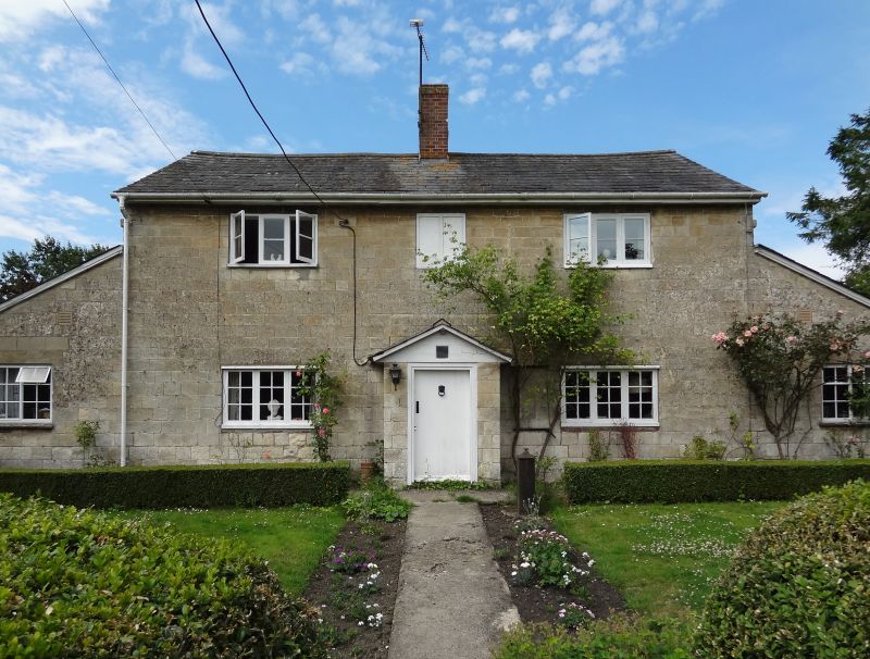
WILCOT THE GREEN
SU 16 SW
5/170 No 43
GV II
Pair of estate cottages, now one house. Early C19. Squared
limestone facade, slate roof. Two storeys, 2 bays with lean-to's
at ends. Central door with C20 pitched porch. C19 casement timber
windows. Central brick stack.
Listing NGR: SU1415661150
External links are from the relevant listing authority and, where applicable, Wikidata. Wikidata IDs may be related buildings as well as this specific building. If you want to add or update a link, you will need to do so by editing the Wikidata entry.


Other nearby listed buildings
