Approximate Location Map
Large Map »
Latitude: 51.3651 / 51°21'54"N
Longitude: -1.7164 / 1°42'59"W
OS Eastings: 419838
OS Northings: 162928
OS Grid: SU198629
Mapcode National: GBR 4XV.BW7
Mapcode Global: VHC1W.6YGD
Plus Code: 9C3W978M+2C
Entry Name: Wootton Rivers Lock and Road Bridge
Listing Date: 30 October 1987
Grade: II
Source: Historic England
Source ID: 1035769
English Heritage Legacy ID: 311862
ID on this website: 101035769
Location: Wootton Rivers, Wiltshire, SN8
County: Wiltshire
Civil Parish: Wootton Rivers
Traditional County: Wiltshire
Lieutenancy Area (Ceremonial County): Wiltshire
Tagged with: Lock Road bridge
WOOTTON RIVERS -
SU 16 SE
6/227 Wootton Rivers Lock and
road bridge
GV II
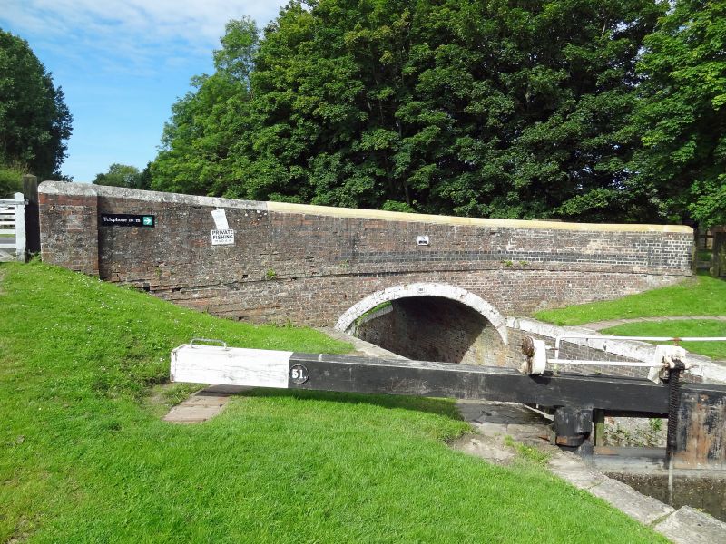
Road bridge over Kennet and Avon Canal, and lock. c1810. By John Rennie. Brick
with string at base of parapet, the parapet sloping with fall of
ground and with whitewashed stone half-round copings. Bull-nosed
bricks to 1½ brick ring. Abutments die into brick walls of lock,
also with stone copings and quoins to rebates for the reconstructed
wood gates. 70ft lock.
Listing NGR: SU1983862928
External links are from the relevant listing authority and, where applicable, Wikidata. Wikidata IDs may be related buildings as well as this specific building. If you want to add or update a link, you will need to do so by editing the Wikidata entry.


Other nearby listed buildings
