Approximate Location Map
Large Map »
Latitude: 51.3149 / 51°18'53"N
Longitude: -1.9428 / 1°56'34"W
OS Eastings: 404082
OS Northings: 157314
OS Grid: SU040573
Mapcode National: GBR 3WT.FNC
Mapcode Global: VHB4P.86ST
Plus Code: 9C3W8374+XV
Entry Name: Unidentified Monument in Churchyard Approximately 3 Metres North of Chancel, Church of St Michael
Listing Date: 25 March 1988
Grade: II
Source: Historic England
Source ID: 1035860
English Heritage Legacy ID: 312094
ID on this website: 101035860
Location: St Michael's Church, Urchfont, Wiltshire, SN10
County: Wiltshire
Civil Parish: Urchfont
Built-Up Area: Urchfont
Traditional County: Wiltshire
Lieutenancy Area (Ceremonial County): Wiltshire
Tagged with: Building
URCHFONT CHURCH LANE
SU 0457
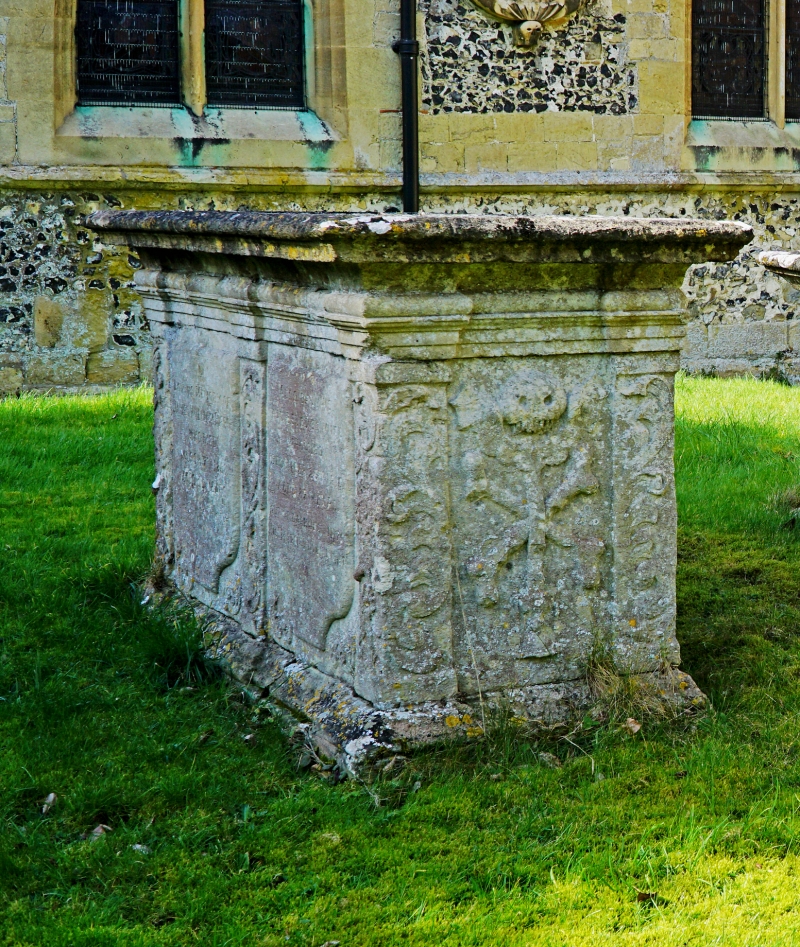
11/189 Unidentified monument in churchyard
approximately 3m north of chancel,
Church of St Michael
II
Chest tomb. Late C18. Limestone. Corniced table. Fielded
panelled sides. End panel with cartouche and death's head, bones
and hourglass. Inscription illegible.
Listing NGR: SU0408257314
External links are from the relevant listing authority and, where applicable, Wikidata. Wikidata IDs may be related buildings as well as this specific building. If you want to add or update a link, you will need to do so by editing the Wikidata entry.


Other nearby listed buildings
