Approximate Location Map
Large Map »
Latitude: 51.3121 / 51°18'43"N
Longitude: -1.9426 / 1°56'33"W
OS Eastings: 404097
OS Northings: 157003
OS Grid: SU040570
Mapcode National: GBR 3WT.MPC
Mapcode Global: VHB4P.88WZ
Plus Code: 9C3W8364+VX
Entry Name: The Forge
Listing Date: 25 March 1988
Grade: II
Source: Historic England
Source ID: 1183248
English Heritage Legacy ID: 312135
ID on this website: 101183248
Location: Urchfont, Wiltshire, SN10
County: Wiltshire
Civil Parish: Urchfont
Built-Up Area: Urchfont
Traditional County: Wiltshire
Lieutenancy Area (Ceremonial County): Wiltshire
Tagged with: Smithy
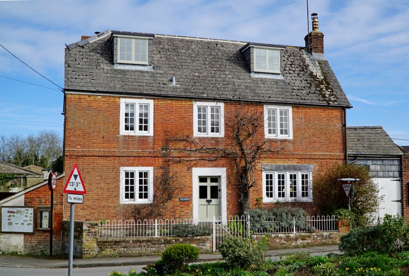
URCHFONT HIGH STREET
SU 0457
(east side)
11/229 The Forge
GV II
House. Mid C18. Greensand, faced in Flemish brickwork. Slate
roof. Two storeys and attics, 3 bays. Central 6-panelled half-
glazed door within bead arris moulded monolithic stone surround.
Two-light casement windows, also with painted moulded stone
surrounds, all openings have gauged brick lintels. Plat band. To
right C20 bow oriel window with felt roof. Two flat roofed
dormers. Stack to right gable, roof half hipped to left.
Listing NGR: SU0409757003
External links are from the relevant listing authority and, where applicable, Wikidata. Wikidata IDs may be related buildings as well as this specific building. If you want to add or update a link, you will need to do so by editing the Wikidata entry.


Other nearby listed buildings
