Approximate Location Map
Large Map »
Latitude: 51.3518 / 51°21'6"N
Longitude: -1.6675 / 1°40'3"W
OS Eastings: 423250
OS Northings: 161469
OS Grid: SU232614
Mapcode National: GBR 5ZF.57M
Mapcode Global: VHC23.19T1
Plus Code: 9C3W982J+PX
Entry Name: 12 and 14
Listing Date: 14 July 1977
Grade: II
Source: Historic England
Source ID: 1194382
English Heritage Legacy ID: 312225
ID on this website: 101194382
Location: Burbage, Wiltshire, SN8
County: Wiltshire
Civil Parish: Burbage
Built-Up Area: Burbage
Traditional County: Wiltshire
Lieutenancy Area (Ceremonial County): Wiltshire
Tagged with: Building Thatched cottage
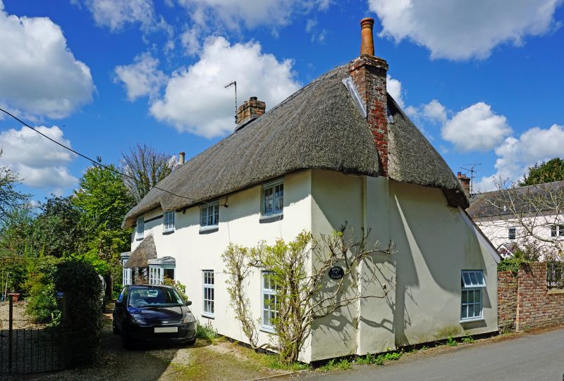
BURBAGE EASTCOURT
SU 26 SW (west side)
2/16 No 12 and 14
14.7.77
II
House. Late C17. Rendered with thatched roof. Concrete tiles to
rear outshut. Two storeys, 4 bays, set at right angles to road.
Entrance between bays 1 and 2, a panelled door with thatched
canopy, flanked by canted bay windows. C20 timber casement windows
with glazing bars throughout. Central brick stack with datestone,
not read, and added stacks to gable ends. Roof hipped.
Listing NGR: SU2325061469
External links are from the relevant listing authority and, where applicable, Wikidata. Wikidata IDs may be related buildings as well as this specific building. If you want to add or update a link, you will need to do so by editing the Wikidata entry.


Other nearby listed buildings
