Approximate Location Map
Large Map »
Latitude: 51.3513 / 51°21'4"N
Longitude: -1.679 / 1°40'44"W
OS Eastings: 422452
OS Northings: 161403
OS Grid: SU224614
Mapcode National: GBR 5ZF.8B1
Mapcode Global: VHC22.V98G
Plus Code: 9C3W982C+GC
Entry Name: 64
Listing Date: 13 June 1988
Grade: II
Source: Historic England
Source ID: 1194569
English Heritage Legacy ID: 312272
ID on this website: 101194569
Location: Westcourt, Wiltshire, SN8
County: Wiltshire
Civil Parish: Burbage
Traditional County: Wiltshire
Lieutenancy Area (Ceremonial County): Wiltshire
Tagged with: Building
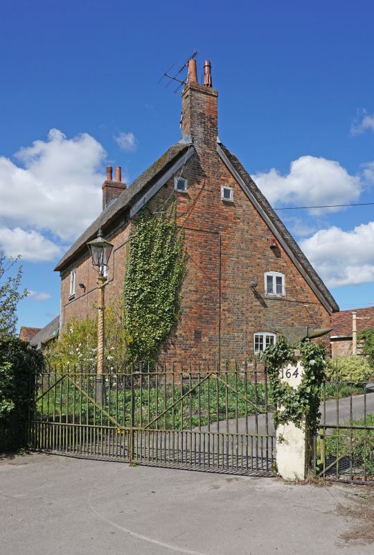
BURBAGE WESTCOURT
SU 26 SW (west side)
2/65 No 64
II
House. C18. Diaper brick with thatched roof. Two storeys and
attic, 3 bays, with single storey 2-bay extension to west gable.
Narrow service rooms to rear under continuation of roof. Central
entrance, a pair of half-glazed doors in deep reveals. Two-light
timber windows. Gable stacks. Left extension has hipped roof.
Listing NGR: SU2245261403
External links are from the relevant listing authority and, where applicable, Wikidata. Wikidata IDs may be related buildings as well as this specific building. If you want to add or update a link, you will need to do so by editing the Wikidata entry.


Other nearby listed buildings
