Approximate Location Map
Large Map »
Latitude: 51.2055 / 51°12'19"N
Longitude: -2.1861 / 2°11'9"W
OS Eastings: 387096
OS Northings: 145160
OS Grid: ST870451
Mapcode National: GBR 1V6.659
Mapcode Global: VH97H.2Y5R
Plus Code: 9C3V6R47+6H
Entry Name: 3, Ash Walk
Listing Date: 31 March 1978
Grade: II
Source: Historic England
Source ID: 1036174
English Heritage Legacy ID: 312826
ID on this website: 101036174
Location: Warminster, Wiltshire, BA12
County: Wiltshire
Civil Parish: Warminster
Built-Up Area: Warminster
Traditional County: Wiltshire
Lieutenancy Area (Ceremonial County): Wiltshire
Church of England Parish: Warminster St Denys
Church of England Diocese: Salisbury
Tagged with: Building
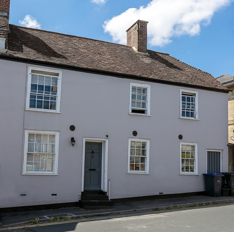
WARMINSTER ASH WALK
1.
5411
No 3
ST 8745 SW 6/88
II GV
2.
C18. 2 storeys. Painted stucco with incised joints on projecting plinth.
Old tile roof, half hipped to right, brick ridge chimney. 1+2 ranges of glazing
bar sash windows. 5 panel door in 2nd bay from left approached by 3 stone
steps and with architrave surround. Plain secondary door in right hand corner.
Listing NGR: ST8709645160
External links are from the relevant listing authority and, where applicable, Wikidata. Wikidata IDs may be related buildings as well as this specific building. If you want to add or update a link, you will need to do so by editing the Wikidata entry.


Other nearby listed buildings
