Approximate Location Map
Large Map »
Latitude: 51.318 / 51°19'4"N
Longitude: -2.2014 / 2°12'4"W
OS Eastings: 386061
OS Northings: 157671
OS Grid: ST860576
Mapcode National: GBR 1ST.88B
Mapcode Global: VH972.S4LG
Plus Code: 9C3V8Q9X+5C
Entry Name: Ashton Mills
Listing Date: 26 November 1976
Grade: II
Source: Historic England
Source ID: 1021674
English Heritage Legacy ID: 314187
ID on this website: 101021674
Location: Longfield, Wiltshire, BA14
County: Wiltshire
Civil Parish: Trowbridge
Built-Up Area: Trowbridge
Traditional County: Wiltshire
Lieutenancy Area (Ceremonial County): Wiltshire
Church of England Parish: Trowbridge St James
Church of England Diocese: Salisbury
Tagged with: Building
WEST ASHTON ROAD
1.
5411
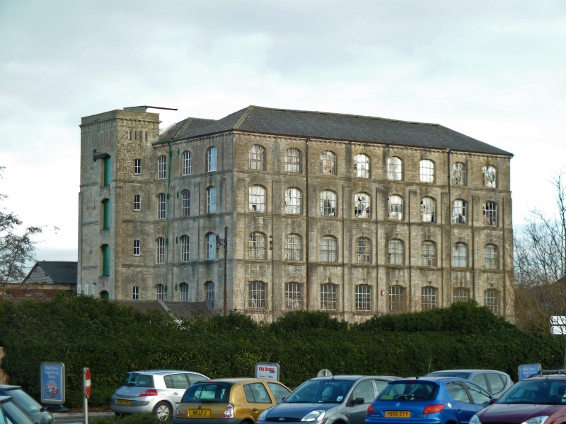
Ashton Mills
ST 8657 12/398
II
2.
Mid C19. Coursed dressed stone on stepped plinth. 5 storeys with hoist tower
at north west corner. 8 by 4 ranges of segmental headed windows. Each storey
slightly set back, with wall buttresses up to 4th floor. Block modillion eaves
cornice. Double ridged hipped slate roof.
Listing NGR: ST8606157671
External links are from the relevant listing authority and, where applicable, Wikidata. Wikidata IDs may be related buildings as well as this specific building. If you want to add or update a link, you will need to do so by editing the Wikidata entry.


Other nearby listed buildings
