Approximate Location Map
Large Map »
Latitude: 51.5363 / 51°32'10"N
Longitude: -2.0801 / 2°4'48"W
OS Eastings: 394538
OS Northings: 181936
OS Grid: ST945819
Mapcode National: GBR 2RL.NWP
Mapcode Global: VH95Z.WNP4
Plus Code: 9C3VGWP9+GW
Entry Name: Startley Farmhouse
Listing Date: 25 November 1987
Grade: II
Source: Historic England
Source ID: 1200324
English Heritage Legacy ID: 316335
ID on this website: 101200324
Location: Startley, Wiltshire, SN15
County: Wiltshire
Civil Parish: Great Somerford
Traditional County: Wiltshire
Lieutenancy Area (Ceremonial County): Wiltshire
Church of England Parish: Great Somerford
Church of England Diocese: Bristol
Tagged with: Farmhouse
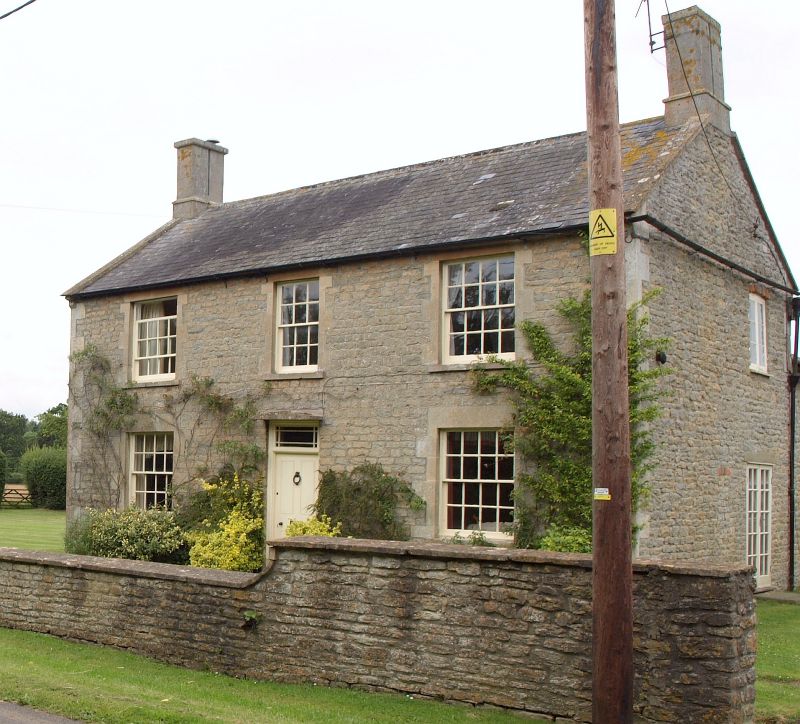
GREAT SOMERFORD STARTLEY
ST 98 SW
2/209 Startley Farmhouse
II
Farmhouse, c1840, squared rubble stone with slate roof, coped
gables and end stacks. Two storeys, three-window range of sashes,
16-pane each side, 12-pane to centre over 4-panel door with margin-
glazed overlight and stone shelf over. Rubble stone north wall,
roughcast south wall.
Listing NGR: ST9453881936
External links are from the relevant listing authority and, where applicable, Wikidata. Wikidata IDs may be related buildings as well as this specific building. If you want to add or update a link, you will need to do so by editing the Wikidata entry.


Other nearby listed buildings
