Approximate Location Map
Large Map »
Latitude: 51.4902 / 51°29'24"N
Longitude: -2.2304 / 2°13'49"W
OS Eastings: 384100
OS Northings: 176836
OS Grid: ST841768
Mapcode National: GBR 1QN.DY7
Mapcode Global: VH963.9S7Y
Plus Code: 9C3VFQR9+3R
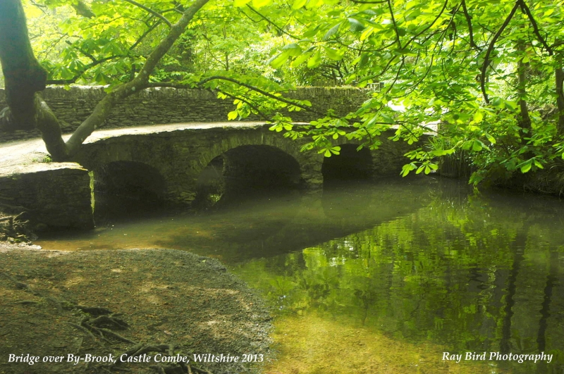
Entry Name: Roman Bridge
Listing Date: 20 December 1960
Grade: II
Source: Historic England
Source ID: 1199255
English Heritage Legacy ID: 317283
ID on this website: 101199255
Location: Castle Combe, Wiltshire, SN14
County: Wiltshire
Civil Parish: Castle Combe
Traditional County: Wiltshire
Lieutenancy Area (Ceremonial County): Wiltshire
Church of England Parish: Castle Combe
Church of England Diocese: Bristol
Tagged with: Bridge
CASTLE COMBE WATERSIDE
ST 87 NW
2/191 Roman Bridge
20.12.60
II
Footbridge, uncertain date, rubble stone. 3 shallow cambered
arches, wider centre span. Rubble stone parapet wall on south
side only.
Listing NGR: ST8410076836
External links are from the relevant listing authority and, where applicable, Wikidata. Wikidata IDs may be related buildings as well as this specific building. If you want to add or update a link, you will need to do so by editing the Wikidata entry.


Other nearby listed buildings
