Approximate Location Map
Large Map »
Latitude: 51.4963 / 51°29'46"N
Longitude: -2.2722 / 2°16'20"W
OS Eastings: 381196
OS Northings: 177518
OS Grid: ST811775
Mapcode National: GBR 0P8.2BM
Mapcode Global: VH962.KNM9
Plus Code: 9C3VFPWH+G4
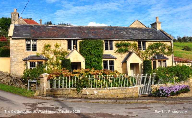
Entry Name: The Old School
Listing Date: 9 December 1985
Grade: II
Source: Historic England
Source ID: 1300582
English Heritage Legacy ID: 317491
ID on this website: 101300582
Location: West Kington, Wiltshire, SN14
County: Wiltshire
Civil Parish: Nettleton
Traditional County: Wiltshire
Lieutenancy Area (Ceremonial County): Wiltshire
Church of England Parish: West Kington
Church of England Diocese: Bristol
Tagged with: School building
NETTLETON WEST KINGTON
ST 87 NW
2/400 The Old School
II
Former schoolroom, early C19, rough rendered rubble stone with slate roof and coped gables with ashlar corniced end wall stacks. Gothick style. 2 moulded pointed Y-tracery windows with leaded lights flanking central flush bead-moulded ogee-arched doorcase.
Listing NGR: ST8119677518
External links are from the relevant listing authority and, where applicable, Wikidata. Wikidata IDs may be related buildings as well as this specific building. If you want to add or update a link, you will need to do so by editing the Wikidata entry.


Other nearby listed buildings
