Approximate Location Map
Large Map »
Latitude: 51.6475 / 51°38'51"N
Longitude: -1.9353 / 1°56'6"W
OS Eastings: 404574
OS Northings: 194307
OS Grid: SU045943
Mapcode National: GBR 3RR.PJW
Mapcode Global: VHB2Y.DVRC
Plus Code: 9C3WJ3X7+2V
Entry Name: Melton Lodge
Listing Date: 17 April 1986
Grade: II
Source: Historic England
Source ID: 1023055
English Heritage Legacy ID: 317672
ID on this website: 101023055
Location: Ashton Keynes, Wiltshire, SN6
County: Wiltshire
Civil Parish: Ashton Keynes
Built-Up Area: Ashton Keynes
Traditional County: Wiltshire
Lieutenancy Area (Ceremonial County): Wiltshire
Church of England Parish: Ashton Keynes
Church of England Diocese: Bristol
Tagged with: Gatehouse
SU 09 SW ASHTON KEYNES BACK LANE
(north side)
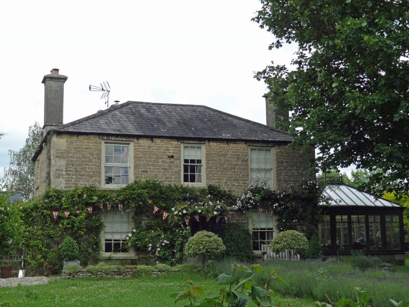
10/23 No. 5 Melton Lodge
II
House, early C19. Coursed limestone rubble with ashlar quoins.
Poor man's slate roof. Three x two bays. Central swept lead-
roofed porch on cast iron supports. Four-pane half-glazed door and
round fanlight. Twelve-pane sashes with radial stone voussoirs as
flat lintel. Roof hipped, with gable stacks.
Listing NGR: SU0457494307
External links are from the relevant listing authority and, where applicable, Wikidata. Wikidata IDs may be related buildings as well as this specific building. If you want to add or update a link, you will need to do so by editing the Wikidata entry.


Other nearby listed buildings
