Approximate Location Map
Large Map »
Latitude: 51.6406 / 51°38'26"N
Longitude: -1.9388 / 1°56'19"W
OS Eastings: 404331
OS Northings: 193537
OS Grid: SU043935
Mapcode National: GBR 3RY.2N8
Mapcode Global: VHB34.B1W4
Plus Code: 9C3WJ3R6+6F
Entry Name: Front Garden Wall to Number 14 and Primrose Cottage
Listing Date: 17 April 1986
Grade: II
Source: Historic England
Source ID: 1023062
English Heritage Legacy ID: 317687
ID on this website: 101023062
Location: Ashton Keynes, Wiltshire, SN6
County: Wiltshire
Civil Parish: Ashton Keynes
Traditional County: Wiltshire
Lieutenancy Area (Ceremonial County): Wiltshire
Church of England Parish: Ashton Keynes
Church of England Diocese: Bristol
Tagged with: Building
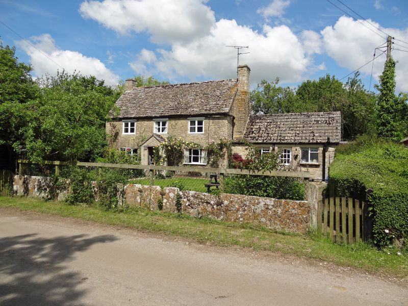
SU 09 SW ASHTON KEYNES THE DERRY
(north side)
11/38 Front garden wall to No. 14 and
Primrose Cottage
II
Orthostatic limestone wall. Undatable. Bordering road in front
of Primrose Cottage and No 14. Approximately 48m run and 6m return
at east end.
Listing NGR: SU0433193537
External links are from the relevant listing authority and, where applicable, Wikidata. Wikidata IDs may be related buildings as well as this specific building. If you want to add or update a link, you will need to do so by editing the Wikidata entry.


Other nearby listed buildings
