Approximate Location Map
Large Map »
Latitude: 51.647 / 51°38'49"N
Longitude: -1.9354 / 1°56'7"W
OS Eastings: 404565
OS Northings: 194250
OS Grid: SU045942
Mapcode National: GBR 3RR.PHZ
Mapcode Global: VHB2Y.DVPR
Plus Code: 9C3WJ3W7+RR
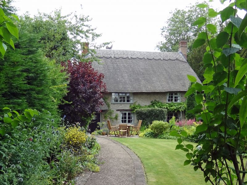
Entry Name: Cock's Thatch
Listing Date: 17 April 1986
Grade: II
Source: Historic England
Source ID: 1023068
English Heritage Legacy ID: 317698
ID on this website: 101023068
Location: Ashton Keynes, Wiltshire, SN6
County: Wiltshire
Civil Parish: Ashton Keynes
Built-Up Area: Ashton Keynes
Traditional County: Wiltshire
Lieutenancy Area (Ceremonial County): Wiltshire
Church of England Parish: Ashton Keynes
Church of England Diocese: Bristol
Tagged with: Building Thatched cottage
SU 09 SW ASHTON KEYNES HIGH ROAD
(east side)
10/49
Cock's Thatch
II
Cottage. C15 or C16. Limestone rubble. Thatched roof. Two-
storeys, entrance to thatched porch at left end. Timber casement
windows. Gable stacks. Thatch is carried low to rear over passage
lean-to.
Interior has 3 pairs of crucks, one pair with windbraces. Apex not
visible.
Listing NGR: SU0456594250
External links are from the relevant listing authority and, where applicable, Wikidata. Wikidata IDs may be related buildings as well as this specific building. If you want to add or update a link, you will need to do so by editing the Wikidata entry.


Other nearby listed buildings
