Approximate Location Map
Large Map »
Latitude: 51.6405 / 51°38'25"N
Longitude: -1.8517 / 1°51'6"W
OS Eastings: 410356
OS Northings: 193530
OS Grid: SU103935
Mapcode National: GBR 3S2.0PD
Mapcode Global: VHB35.V1F7
Plus Code: 9C3WJ4RX+58
Entry Name: 23, Calcutt Street
Listing Date: 26 August 1976
Grade: II
Source: Historic England
Source ID: 1182905
English Heritage Legacy ID: 317753
ID on this website: 101182905
Location: Cricklade, Wiltshire, SN6
County: Wiltshire
Civil Parish: Cricklade
Built-Up Area: Cricklade
Traditional County: Wiltshire
Lieutenancy Area (Ceremonial County): Wiltshire
Church of England Parish: Cricklade
Church of England Diocese: Bristol
Tagged with: Building
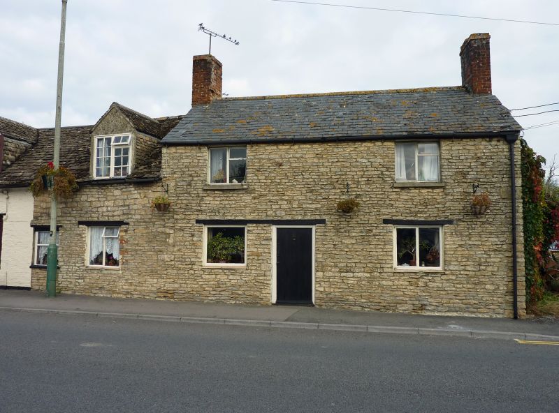
SU 19 SW CRICKLADE CALCUTT STREET
(north side)
13/104 No. 23
26.8.76
GV
II
Cottage, early-mid C19 rebuilding. Painted rubble. Welsh slate
roof. Two storeys, 2 bays. Doorway off-centre to left, C20
boarded door. C20 metal casement windows with timber lintels to
the ground floor. Gable stacks. Included for group value.
Listing NGR: SU1035693530
External links are from the relevant listing authority and, where applicable, Wikidata. Wikidata IDs may be related buildings as well as this specific building. If you want to add or update a link, you will need to do so by editing the Wikidata entry.


Other nearby listed buildings
