Approximate Location Map
Large Map »
Latitude: 51.6387 / 51°38'19"N
Longitude: -1.858 / 1°51'28"W
OS Eastings: 409920
OS Northings: 193334
OS Grid: SU099933
Mapcode National: GBR 3S1.C16
Mapcode Global: VHB35.R22L
Plus Code: 9C3WJ4QR+FQ
Entry Name: 1, High Street
Listing Date: 26 August 1976
Grade: II
Source: Historic England
Source ID: 1023095
English Heritage Legacy ID: 317765
ID on this website: 101023095
Location: Cricklade, Wiltshire, SN6
County: Wiltshire
Civil Parish: Cricklade
Built-Up Area: Cricklade
Traditional County: Wiltshire
Lieutenancy Area (Ceremonial County): Wiltshire
Church of England Parish: Cricklade
Church of England Diocese: Bristol
Tagged with: Building
SU 09 SE CRICKLADE HIGH STREET
(west side)
12/116 No. 1
(formerly listed as Town Bridge No 1)
26.8.76
II
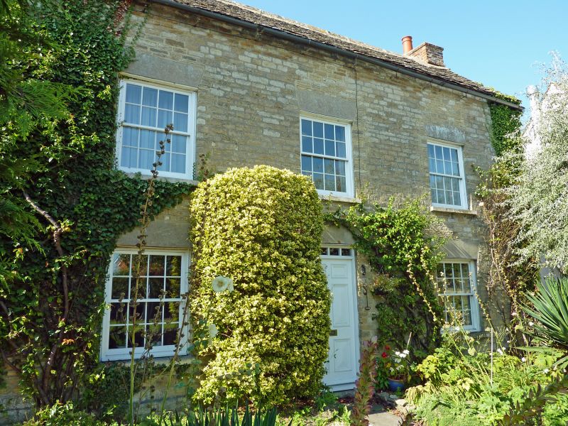
House. Early C19. Coursed limestone rubble with stone slate roof.
Two-storeys, 3 bays. Plain central doorway with C20 six-panel door
and narrow fanlight. Sixteen-pane sashes. Brick gable stacks.
Lean-to extension to rear.
Listing NGR: SU0992093334
External links are from the relevant listing authority and, where applicable, Wikidata. Wikidata IDs may be related buildings as well as this specific building. If you want to add or update a link, you will need to do so by editing the Wikidata entry.


Other nearby listed buildings
