Approximate Location Map
Large Map »
Latitude: 51.6391 / 51°38'20"N
Longitude: -1.8579 / 1°51'28"W
OS Eastings: 409929
OS Northings: 193374
OS Grid: SU099933
Mapcode National: GBR 3S1.538
Mapcode Global: VHB35.R259
Plus Code: 9C3WJ4QR+JR
Entry Name: 8, High Street
Listing Date: 17 April 1986
Grade: II
Source: Historic England
Source ID: 1182965
English Heritage Legacy ID: 317766
ID on this website: 101182965
Location: Cricklade, Wiltshire, SN6
County: Wiltshire
Civil Parish: Cricklade
Built-Up Area: Cricklade
Traditional County: Wiltshire
Lieutenancy Area (Ceremonial County): Wiltshire
Church of England Parish: Cricklade
Church of England Diocese: Bristol
Tagged with: Building
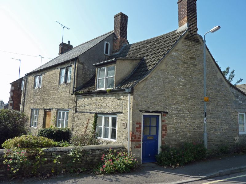
SU 09 SE CRICKLADE HIGH STREET
12/188 No. 8
II
House, C18 or early C19. Limestone rubble, slate and concrete tile
roof. 2 storeys, main block of 2 bays, extended to right by 1 bay
1 storey and attic. Central 6-panel door, the upper panels glazed.
3-light casement windows, all openings with timber lintels. Flush
dormer to extension. Left gable stack and 2 brick stacks to
extension. C20 lean-to at rear.
Listing NGR: SU0992993374
External links are from the relevant listing authority and, where applicable, Wikidata. Wikidata IDs may be related buildings as well as this specific building. If you want to add or update a link, you will need to do so by editing the Wikidata entry.


Other nearby listed buildings
