Approximate Location Map
Large Map »
Latitude: 51.6405 / 51°38'25"N
Longitude: -1.8571 / 1°51'25"W
OS Eastings: 409987
OS Northings: 193533
OS Grid: SU099935
Mapcode National: GBR 3S1.59B
Mapcode Global: VHB35.R1L6
Plus Code: 9C3WJ4RV+65
Entry Name: Outbuilding at Rear of Number 23
Listing Date: 26 August 1976
Grade: II
Source: Historic England
Source ID: 1023096
English Heritage Legacy ID: 317769
ID on this website: 101023096
Location: Cricklade, Wiltshire, SN6
County: Wiltshire
Civil Parish: Cricklade
Built-Up Area: Cricklade
Traditional County: Wiltshire
Lieutenancy Area (Ceremonial County): Wiltshire
Church of England Parish: Cricklade
Church of England Diocese: Bristol
Tagged with: Appendage
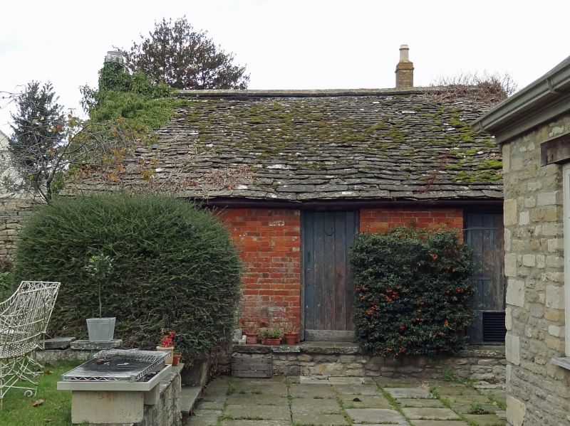
SU 09 SE CRICKLADE HIGH STREET
(west side)
12/119 Outbuilding at rear of No. 23
26.8.76
GV II
Outhouse. C18 or early C19. Diaper brick. Stone slate roof.
Doors to store and tool sheds. East gable part perforated as
dovecote.
Listing NGR: SU0998493533
External links are from the relevant listing authority and, where applicable, Wikidata. Wikidata IDs may be related buildings as well as this specific building. If you want to add or update a link, you will need to do so by editing the Wikidata entry.


Other nearby listed buildings
