Approximate Location Map
Large Map »
Latitude: 51.6431 / 51°38'35"N
Longitude: -1.8551 / 1°51'18"W
OS Eastings: 410121
OS Northings: 193826
OS Grid: SU101938
Mapcode National: GBR 3RV.ZS3
Mapcode Global: VHB2Z.SYMR
Plus Code: 9C3WJ4VV+7X
Entry Name: 57, High Street
Listing Date: 26 August 1976
Grade: II
Source: Historic England
Source ID: 1183146
English Heritage Legacy ID: 317793
ID on this website: 101183146
Location: Cricklade, Wiltshire, SN6
County: Wiltshire
Civil Parish: Cricklade
Built-Up Area: Cricklade
Traditional County: Wiltshire
Lieutenancy Area (Ceremonial County): Wiltshire
Church of England Parish: Cricklade
Church of England Diocese: Bristol
Tagged with: Building
SU 19 SW CRICKLADE HIGH STREET
(west side)
13/143 No. 57
26.8.76
GV II
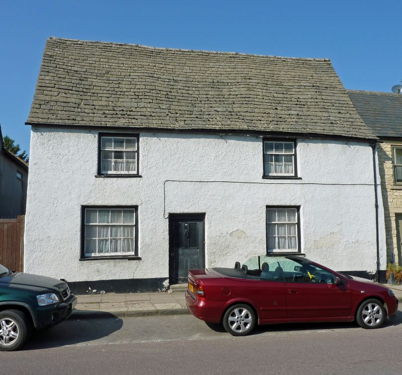
House. Colourwashed roughcast, concrete slate roof. Two storeys,
3 bays. Central 4-panelled door, 3 x 9-pane single hung sashes,
and one 12-pane single hung to left of door. Stack to rear left.
Listing NGR: SU1011893827
External links are from the relevant listing authority and, where applicable, Wikidata. Wikidata IDs may be related buildings as well as this specific building. If you want to add or update a link, you will need to do so by editing the Wikidata entry.


Other nearby listed buildings
