Approximate Location Map
Large Map »
Latitude: 51.6432 / 51°38'35"N
Longitude: -1.8547 / 1°51'16"W
OS Eastings: 410149
OS Northings: 193836
OS Grid: SU101938
Mapcode National: GBR 3RV.ZWY
Mapcode Global: VHB2Z.SYVP
Plus Code: 9C3WJ4VW+74
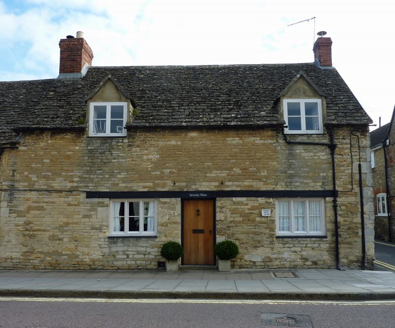
Entry Name: 78 and 79, High Street
Listing Date: 25 August 1976
Grade: II
Source: Historic England
Source ID: 1284156
English Heritage Legacy ID: 317817
ID on this website: 101284156
Location: Cricklade, Wiltshire, SN6
County: Wiltshire
Civil Parish: Cricklade
Built-Up Area: Cricklade
Traditional County: Wiltshire
Lieutenancy Area (Ceremonial County): Wiltshire
Church of England Parish: Cricklade
Church of England Diocese: Bristol
Tagged with: Building
SU 19 SW CRICKLADE HIGH STREET
(east side)
13/167 Nos. 78 and 79
25.8.76
GV II
Two cottages, end of row. Limestone rubble with stone slate roofs.
Each single storey and attic, 2 bays with off-centre recessed door.
No.78 has 2-light casements, No.79 3-light and both have flush
gabled 2-light dormers. Gable end brick stacks.
Listing NGR: SU1015593841
External links are from the relevant listing authority and, where applicable, Wikidata. Wikidata IDs may be related buildings as well as this specific building. If you want to add or update a link, you will need to do so by editing the Wikidata entry.


Other nearby listed buildings
