Approximate Location Map
Large Map »
Latitude: 51.6423 / 51°38'32"N
Longitude: -1.8554 / 1°51'19"W
OS Eastings: 410104
OS Northings: 193728
OS Grid: SU101937
Mapcode National: GBR 3RV.ZPV
Mapcode Global: VHB2Z.SZHF
Plus Code: 9C3WJ4RV+WV
Entry Name: 92, High Street
Listing Date: 25 August 1976
Grade: II
Source: Historic England
Source ID: 1023119
English Heritage Legacy ID: 317824
ID on this website: 101023119
Location: Cricklade, Wiltshire, SN6
County: Wiltshire
Civil Parish: Cricklade
Built-Up Area: Cricklade
Traditional County: Wiltshire
Lieutenancy Area (Ceremonial County): Wiltshire
Church of England Parish: Cricklade
Church of England Diocese: Bristol
Tagged with: Building
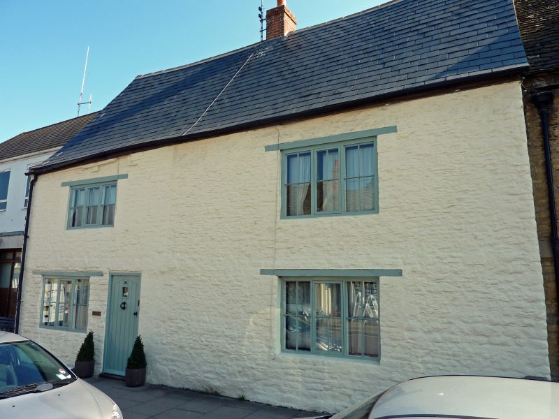
SU 19 SW CRICKLADE HIGH STREET
(east side)
13/174 No. 92
25.8.76
GV II
House in row. C17. Painted limestone rubble. Asbestos slate
roof. Two storeys, 2 bays. Off-centre C20 8-panel door and 3-
light casement windows to ground floor, and first floor, all with
wood lintels. Central brick stack.
Listing NGR: SU1010493730
External links are from the relevant listing authority and, where applicable, Wikidata. Wikidata IDs may be related buildings as well as this specific building. If you want to add or update a link, you will need to do so by editing the Wikidata entry.


Other nearby listed buildings
