Approximate Location Map
Large Map »
Latitude: 51.6421 / 51°38'31"N
Longitude: -1.8555 / 1°51'19"W
OS Eastings: 410096
OS Northings: 193711
OS Grid: SU100937
Mapcode National: GBR 3RV.ZNM
Mapcode Global: VHB2Z.SZFJ
Plus Code: 9C3WJ4RV+RR
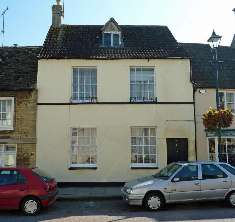
Entry Name: 94, High Street
Listing Date: 25 August 1976
Grade: II
Source: Historic England
Source ID: 1023120
English Heritage Legacy ID: 317826
ID on this website: 101023120
Location: Cricklade, Wiltshire, SN6
County: Wiltshire
Civil Parish: Cricklade
Built-Up Area: Cricklade
Traditional County: Wiltshire
Lieutenancy Area (Ceremonial County): Wiltshire
Church of England Parish: Cricklade
Church of England Diocese: Bristol
Tagged with: Building
SU 19 SW CRICKLADE HIGH STREET
(east side)
13/176 No. 94
25.8.76
GV II
House in row. Circa 1840. Rendered with drawn ashlar. Machine
tile roof. Two storeys and attic. Two bays. Six-panel door to
right. Sixteen-pane sashes to each floor and central gabled dormer.
Stack to left gable. Long L-plan rear extension.
Listing NGR: SU1010393708
External links are from the relevant listing authority and, where applicable, Wikidata. Wikidata IDs may be related buildings as well as this specific building. If you want to add or update a link, you will need to do so by editing the Wikidata entry.


Other nearby listed buildings
