Approximate Location Map
Large Map »
Latitude: 51.5728 / 51°34'21"N
Longitude: -1.8665 / 1°51'59"W
OS Eastings: 409348
OS Northings: 185996
OS Grid: SU093859
Mapcode National: GBR 3ST.8YC
Mapcode Global: VHB3C.LQMP
Plus Code: 9C3WH4FM+4C
Entry Name: Churchyard Cross
Listing Date: 17 April 1986
Grade: II
Source: Historic England
Source ID: 1023144
English Heritage Legacy ID: 317882
ID on this website: 101023144
Location: Lydiard Millicent, Wiltshire, SN5
County: Wiltshire
Civil Parish: Lydiard Millicent
Built-Up Area: Lydiard Millicent
Traditional County: Wiltshire
Lieutenancy Area (Ceremonial County): Wiltshire
Church of England Parish: West Swindon and the Lydiards
Church of England Diocese: Bristol
Tagged with: Churchyard cross
SU 08 NE
8/232
LYDIARD MILLICENT
THE STREET
(north side)
Churchyard Cross
GV
II
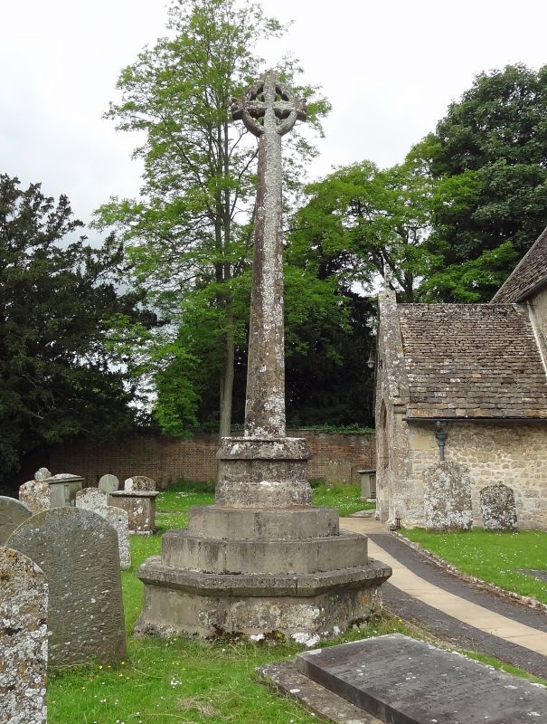
Churchyard cross. Medieval and C19. Limestone. Octagonal shaft,
returning to square at base. Coped octagonal base. All set on 3
C19 high steps and provided with wheel-cross head.
Listing NGR: SU0934885996
External links are from the relevant listing authority and, where applicable, Wikidata. Wikidata IDs may be related buildings as well as this specific building. If you want to add or update a link, you will need to do so by editing the Wikidata entry.


Other nearby listed buildings
