Approximate Location Map
Large Map »
Latitude: 51.5873 / 51°35'14"N
Longitude: -1.87 / 1°52'11"W
OS Eastings: 409103
OS Northings: 187612
OS Grid: SU091876
Mapcode National: GBR 3SM.G1C
Mapcode Global: VHB3C.JCRJ
Plus Code: 9C3WH4PJ+W2
Entry Name: Gateway to College Farm
Listing Date: 17 April 1986
Grade: II
Source: Historic England
Source ID: 1198379
English Heritage Legacy ID: 317964
ID on this website: 101198379
Location: Purton, Wiltshire, SN5
County: Wiltshire
Civil Parish: Purton
Built-Up Area: Purton
Traditional County: Wiltshire
Lieutenancy Area (Ceremonial County): Wiltshire
Church of England Parish: Purton
Church of England Diocese: Bristol
Tagged with: Gate
SU 08 NE
8/317
PURTON
HIGH STREET
(north side)
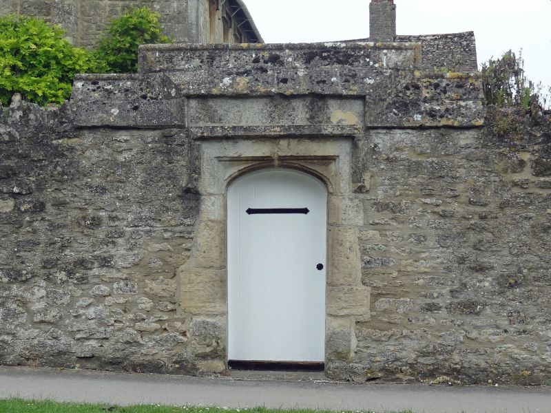
Gateway to College Farm
II
Gateway within roadside wall. C17. Limestone ashlar in rubble
walling. 3 centred moulded arch with blind spandrels and hood
mould in section of wall with ashlar weathered copings with roll
apex, the coping stepped up over gate. Wall beyond weathered
coping rebuilt and not of special interest
Listing NGR: SU0910387612
External links are from the relevant listing authority and, where applicable, Wikidata. Wikidata IDs may be related buildings as well as this specific building. If you want to add or update a link, you will need to do so by editing the Wikidata entry.


Other nearby listed buildings
