Approximate Location Map
Large Map »
Latitude: 51.5899 / 51°35'23"N
Longitude: -1.8662 / 1°51'58"W
OS Eastings: 409365
OS Northings: 187903
OS Grid: SU093879
Mapcode National: GBR 3SM.90F
Mapcode Global: VHB3C.L9SJ
Plus Code: 9C3WH4QM+XG
Entry Name: Collins Lane Gate
Listing Date: 17 April 1986
Grade: II
Source: Historic England
Source ID: 1356029
English Heritage Legacy ID: 317985
ID on this website: 101356029
Location: Purton, Wiltshire, SN5
County: Wiltshire
Civil Parish: Purton
Built-Up Area: Purton
Traditional County: Wiltshire
Lieutenancy Area (Ceremonial County): Wiltshire
Church of England Parish: Purton
Church of England Diocese: Bristol
Tagged with: Gate
SU 08 NE
8/339
PURTON
STATION ROAD
(west side)
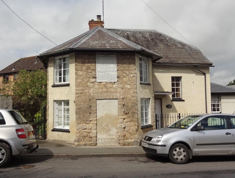
No. 65 (Collins Lane Gate)
II
Toll cottage. Early C19. Limestone rubble, partly rendered, and
slate roof. Two storeys, with canted front on to road. Blocked
central door and painted toll board over with prescribed stages and
charges. C20 metal windows. House extended to rear with 2-bay
roughcast and slated building with half-glazed door windows and
half-hipped roof.
Listing NGR: SU0936587903
External links are from the relevant listing authority and, where applicable, Wikidata. Wikidata IDs may be related buildings as well as this specific building. If you want to add or update a link, you will need to do so by editing the Wikidata entry.


Other nearby listed buildings
