Approximate Location Map
Large Map »
Latitude: 51.6153 / 51°36'55"N
Longitude: -1.7804 / 1°46'49"W
OS Eastings: 415298
OS Northings: 190741
OS Grid: SU152907
Mapcode National: GBR 4TP.LPD
Mapcode Global: VHB37.3N3L
Plus Code: 9C3WJ689+4R
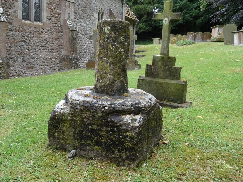
Entry Name: Churchyard Cross
Listing Date: 20 September 1979
Grade: II
Source: Historic England
Source ID: 1023287
English Heritage Legacy ID: 318233
ID on this website: 101023287
Location: St Leonard's Church, Broad Blunsdon, Swindon, Wiltshire, SN26
County: Swindon
Civil Parish: Blunsdon St Andrew
Built-Up Area: Broad Blunsdon
Traditional County: Wiltshire
Lieutenancy Area (Ceremonial County): Wiltshire
Church of England Parish: Broad Blunsdon
Church of England Diocese: Bristol
Tagged with: Churchyard cross
SU 1590
21/76
BLUNSDON ST ANDREW
Broad Blunsdon
High Street
Churchyard Cross
II
GV
Base of cross outside south porch. Late medieval. Square plinth, upper part
chamfered. Chamfered shaft with pyramidal stops. Sundial inserted.
Listing NGR: SU1529890741
External links are from the relevant listing authority and, where applicable, Wikidata. Wikidata IDs may be related buildings as well as this specific building. If you want to add or update a link, you will need to do so by editing the Wikidata entry.


Other nearby listed buildings
