Approximate Location Map
Large Map »
Latitude: 51.5226 / 51°31'21"N
Longitude: -1.7516 / 1°45'5"W
OS Eastings: 417332
OS Northings: 180436
OS Grid: SU173804
Mapcode National: GBR 4VW.FZ5
Mapcode Global: VHB3M.LZCN
Plus Code: 9C3WG6FX+29
Entry Name: Store to East of Hodson Farmhouse
Listing Date: 20 September 1979
Grade: II
Source: Historic England
Source ID: 1355976
English Heritage Legacy ID: 318308
ID on this website: 101355976
Location: Hodson, Swindon, Wiltshire, SN4
County: Swindon
Civil Parish: Chiseldon
Traditional County: Wiltshire
Lieutenancy Area (Ceremonial County): Wiltshire
Tagged with: Agricultural structure
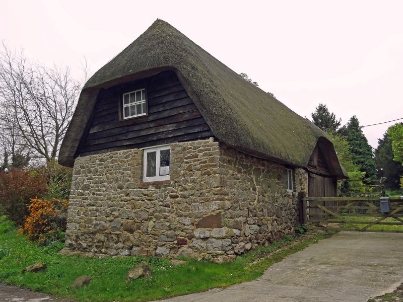
1.
5410 CHISELDON HODSON
Store to east of
Hodson Farmhouse
SU 18 SE 11/168
II GV
2.
Former stable. Sarsen rubble and thatched. Probably C18. West front has weatherboarded
eyebrow dormer for loft over wide entrance. Half Upped to road with one range
of windows; weatherboarded first floor.
Listing NGR: SU1733280436
External links are from the relevant listing authority and, where applicable, Wikidata. Wikidata IDs may be related buildings as well as this specific building. If you want to add or update a link, you will need to do so by editing the Wikidata entry.


Other nearby listed buildings
