Approximate Location Map
Large Map »
Latitude: 51.5244 / 51°31'27"N
Longitude: -1.7512 / 1°45'4"W
OS Eastings: 417357
OS Northings: 180638
OS Grid: SU173806
Mapcode National: GBR 4VW.836
Mapcode Global: VHB3M.LYK8
Plus Code: 9C3WG6FX+QG
Entry Name: 28 and 29
Listing Date: 26 January 1955
Grade: II
Source: Historic England
Source ID: 1184426
English Heritage Legacy ID: 318314
ID on this website: 101184426
Location: Hodson, Swindon, Wiltshire, SN4
County: Swindon
Civil Parish: Chiseldon
Traditional County: Wiltshire
Lieutenancy Area (Ceremonial County): Wiltshire
Tagged with: Building
1.
5410 CHISELDON HODSON
Nos 28 and 29
SU 18 SE 11/174 26.1.55
II
2.
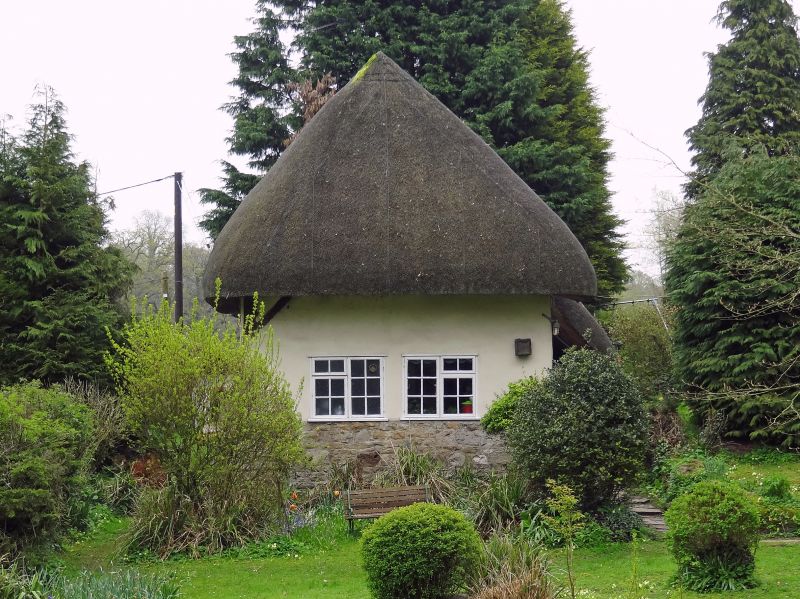
Probably C16 though possibly older. Part timber-framed. Front: 1 1/2 storeys thatched.
one,brick chimney. Rendered on sarsen plinth, brick and stone end to right.
Three eyebrow dormers. Three windows and catslide glazed porch. Rear: centre
bay sarsen rubble flanked by timber-framed side bays, box frame to left, stud
frame to right. One. eyebrow dormer. Interior, one wind brace visible and a
hip cruck (or gavel-fork).
Listing NGR: SU1732480473
External links are from the relevant listing authority and, where applicable, Wikidata. Wikidata IDs may be related buildings as well as this specific building. If you want to add or update a link, you will need to do so by editing the Wikidata entry.


Other nearby listed buildings
