Approximate Location Map
Large Map »
Latitude: 51.5152 / 51°30'54"N
Longitude: -1.7357 / 1°44'8"W
OS Eastings: 418436
OS Northings: 179614
OS Grid: SU184796
Mapcode National: GBR 4VX.S10
Mapcode Global: VHB3T.V5RT
Plus Code: 9C3WG787+3P
Entry Name: 27, Turnball
Listing Date: 20 September 1979
Grade: II
Source: Historic England
Source ID: 1355979
English Heritage Legacy ID: 318335
ID on this website: 101355979
Location: Chiseldon, Swindon, Wiltshire, SN4
County: Swindon
Civil Parish: Chiseldon
Built-Up Area: Chiseldon
Traditional County: Wiltshire
Lieutenancy Area (Ceremonial County): Wiltshire
Tagged with: Building Thatched cottage
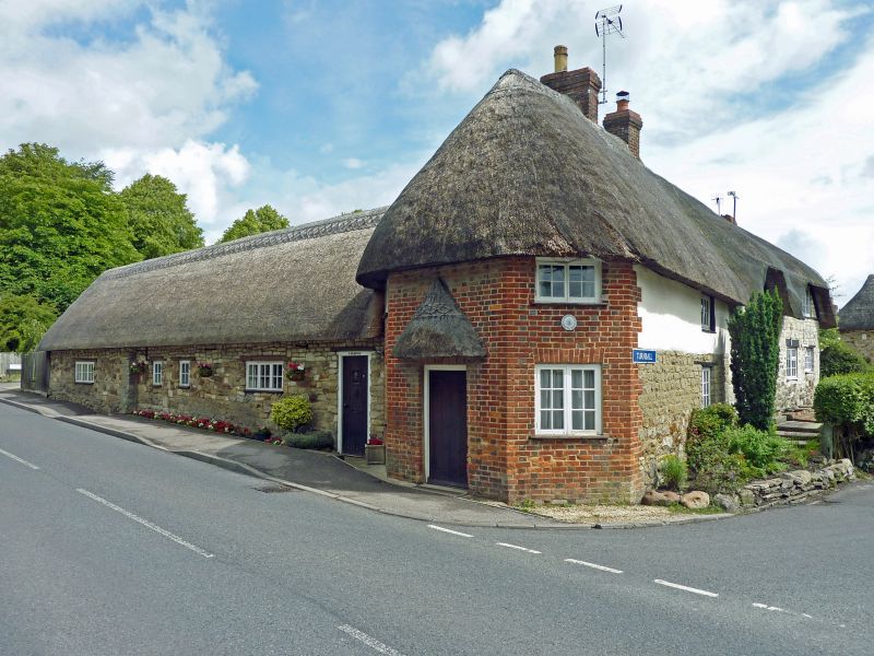
1.
5410 CHISELDON TURNBALL
No 27
SU 1879 29/192
II GV
2.
Circa 1814. Former toll-house. Red brick with blue headers, angled to (Hodson)
Road. Two light windows, central modern porch. Thatched roof. Part rendered
stone (with one range of 2 light windows). Long rubble thatched roofed (now
with corrugated iron over) range of single storey outbuildings to north.
Listing NGR: SU1843679614
External links are from the relevant listing authority and, where applicable, Wikidata. Wikidata IDs may be related buildings as well as this specific building. If you want to add or update a link, you will need to do so by editing the Wikidata entry.


Other nearby listed buildings
