Approximate Location Map
Large Map »
Latitude: 51.6374 / 51°38'14"N
Longitude: -1.7484 / 1°44'54"W
OS Eastings: 417508
OS Northings: 193203
OS Grid: SU175932
Mapcode National: GBR 4TJ.8SQ
Mapcode Global: VHB37.N31M
Plus Code: 9C3WJ7P2+WJ
Entry Name: The Jolly Tar Public House
Listing Date: 20 September 1979
Grade: II
Source: Historic England
Source ID: 1355946
English Heritage Legacy ID: 318351
ID on this website: 101355946
Location: Hannington, Swindon, Wiltshire, SN6
County: Swindon
Civil Parish: Hannington
Traditional County: Wiltshire
Lieutenancy Area (Ceremonial County): Wiltshire
Church of England Parish: Highworth with Sevenhampton and Inglesham etc
Church of England Diocese: Bristol
Tagged with: Pub
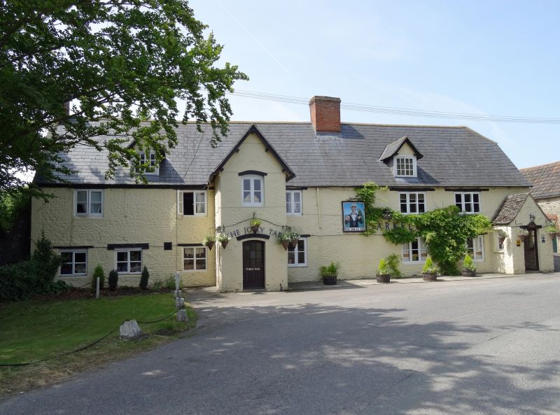
1.
5410 HANNINGTON QUREN'S ROAD
(south side)
The Jolly Tar
Public House
SU 19 SE 5/221
II GV
2.
C18. Two and a half storeys. Painted rubble with wooden lintels. Slate
roof, half hipped to right. Two ridge chimneys. Two gabled dormers, with
Yorkshire sashes. Mid C19 gabled tower porch to right. Two+one+three bays,
2 and 3 light casement windows.
Listing NGR: SU1750893203
External links are from the relevant listing authority and, where applicable, Wikidata. Wikidata IDs may be related buildings as well as this specific building. If you want to add or update a link, you will need to do so by editing the Wikidata entry.


Other nearby listed buildings
